Cusco Map
Cusco is a compact Andean city where nearly everything a visitor needs sits within walking distance of the Plaza de Armas, and every day trip fans out from that same point.
Short answer
Cusco's historic centre is small and walkable: the Plaza de Armas at 3,335 m is the reference point, San Blas climbs the hill to its east, Saqsaywaman and Cristo Blanco sit on the hills to the north, and the day-trip destinations, from the Sacred Valley to Rainbow Mountain, all radiate out by road or rail.
Cusco, the historic city in the Andes of southern Peru, is one of the easiest cities in South America to hold in your head once you have seen its shape on a map. The Plaza de Armas sits at 3,335 m, and almost the entire historic centre folds into the valley and hillsides around it: San Blas on the hill to the east, Saqsaywaman and the Cristo Blanco statue on the hills to the north, the train and bus infrastructure in the lower ground to the south and west. Every itinerary in the region, from the Sacred Valley to Machu Picchu, begins from this one point, so understanding the map of Cusco is really understanding how the whole region is organised. This guide walks through the city district by district, then follows the roads and rails outward.
How Is Cusco Laid Out On A Map?
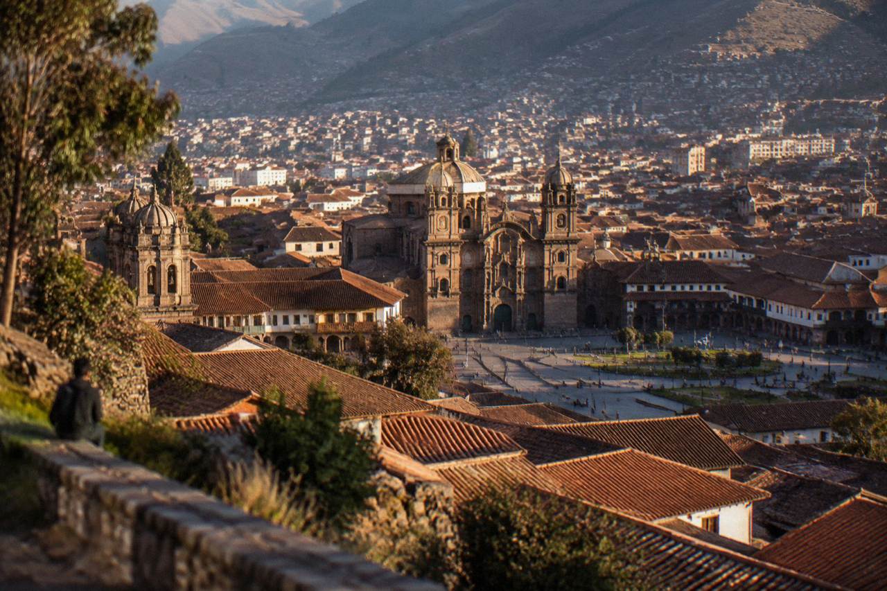
Cusco's historic centre occupies a shallow, high valley at about 3,335 m, with the Plaza de Armas at the old centre, the artisan quarter of San Blas on the hill to its east, and the Inca sites of Saqsaywaman, Q'enqo, Puka Pukara and Tambomachay strung along the hills to the north. The airport sits about 6 km away, and the city's 428,450 residents (2017 census) spread across the surrounding slopes.
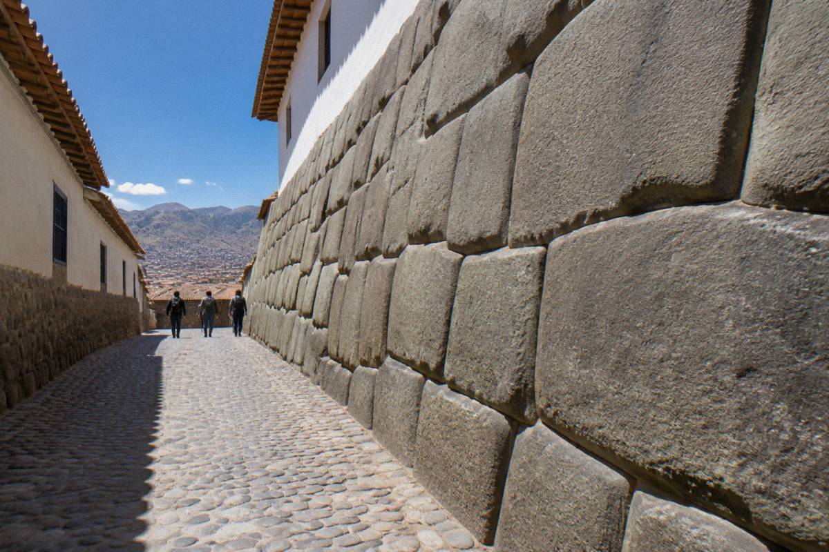
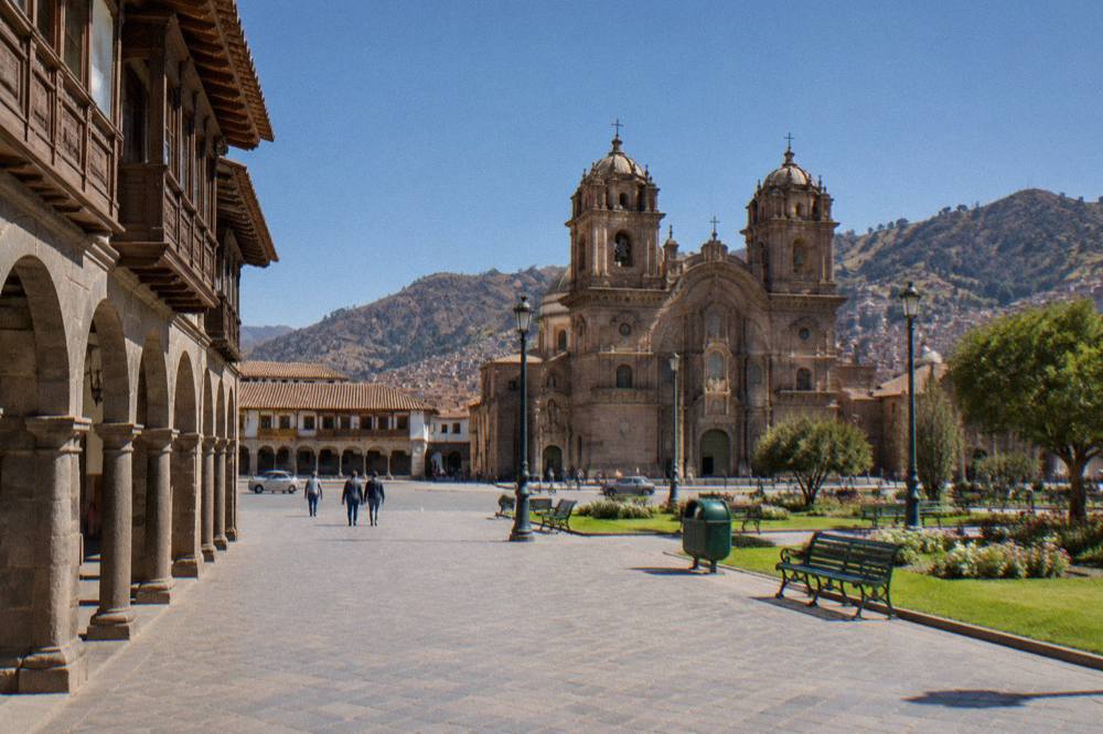
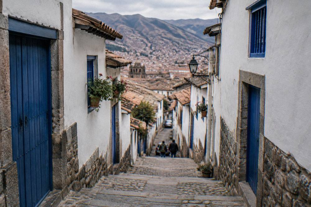
The city was the capital of the Inca empire, and its colonial churches stand on Inca stone foundations; UNESCO inscribed the City of Cusco on the World Heritage List in 1983. That layered history explains the map. The core is a tight grid of narrow streets around the Plaza de Armas, where the Cathedral and the church of the Compania de Jesus face each other across the square. Streets radiate outward and upward: Hatunrumiyoc, with its famous twelve-angled stone, runs toward San Blas, and the steep lanes beyond it climb into the artisan quarter with its small workshops and viewpoints over the red tile roofs.
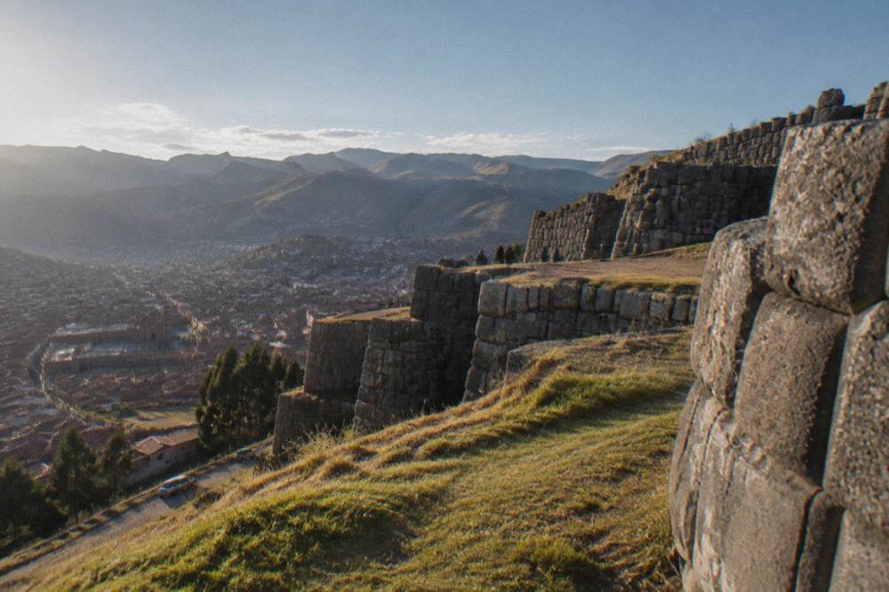
North of the centre, the ground rises sharply to the Saqsaywaman archaeological park. The site record for this region places Saqsaywaman at 3,701 m, several hundred metres above the Plaza de Armas, and the walk up from the city is a genuine climb on a trail and staircases. The four ruin sites of Circuit I of the Boleto Turistico, Saqsaywaman, Q'enqo, Puka Pukara and Tambomachay, sit roughly in a line along the road north of the city, which is why a half-day city tour can cover all four. The site four ruins of Cusco pages describe this circuit in detail.
For a first orientation, the Cusco walking tour with experienced local guides covers the historic centre on foot, and its listing shows the current price and availability: Check availability. GuruWalk also lists several free, tip-based walking tours of the historic centre, including the YANA walking tour of the historic centre run by Yana Tour Operator and Frank Emerson's free tour with a local guide.
Which Districts Of Cusco Should A Visitor Know?
The five areas that matter on a Cusco map are the Plaza de Armas and surrounding historic centre, the San Blas hillside to the east, the San Pedro market and station quarter to the west, the Saqsaywaman hills to the north, and the modern sprawl of the outlying districts, where most of the city's 428,450 residents actually live.
The historic centre is where nearly every visitor stays and spends their first days. The Plaza de Armas anchors it, with the Cathedral on one flank and colonial arcades around the rest. Within a few blocks sit the Qorikancha site museum, the twelve-angled stone on Hatunrumiyoc street, the Inca Museum and the Museum of Pre-Columbian Art. All of it is walkable, and all of it is uphill or downhill from wherever you stand, which is the defining feature of the Cusco map.
To get oriented in the historic centre with a local guide, book a free walking tour here.
San Blas climbs the hill to the east of the Plaza. Its steep lanes hold artisan workshops, small cafes and some of the best rooftop views over the city, and the walk down to the Plaza takes only minutes. The quarter around San Pedro market, west and slightly downhill from the centre, is where the city shops and eats the way locals do; the San Pedro market guide covers it. The San Pedro train station for the Sacred Valley line sits in this quarter too, one of the two Cusco-area stations the rail operator uses.
The hills to the north hold the archaeological park and the Cristo Blanco statue above it. Beyond the mapped tourist zone, the modern city spreads across the surrounding hills, and the where to stay in Cusco guide explains which of these areas make practical bases.
How Far Apart Are The Main Cusco Sites On Foot?
The historic centre of Cusco is compact enough that nearly every central site is within a 15-minute walk of the Plaza de Armas, but the walking is steep and at 3,335 m of altitude, so the map's short distances take longer than they look, and the Saqsaywaman sites above the city are a real uphill climb rather than a stroll.
Distances in the centre are genuinely small. The Cathedral stands on the Plaza itself. The Qorikancha site museum, the Inca Museum, the twelve-angled stone and the San Pedro market all sit within a few blocks of the square, linked by streets that rise and fall with the terrain. San Blas is a short but steep climb east of the Plaza, and the descent back is quick.
The northern hills are different. Saqsaywaman sits at 3,701 m, several hundred metres above the Plaza de Armas, and the trail up from the city is a sustained climb on stairs and dirt path. The walk from Cusco to Saqsaywaman is a popular acclimatisation outing precisely because it is short on the map but demanding on the legs. Once at the top, the road continues past Q'enqo, Puka Pukara and Tambomachay, which is why tours and taxis cover the four sites together rather than walking between them.
The altitude changes the arithmetic everywhere. A route that looks like ten minutes on a flat-city map can take twice that in Cusco, and the Cusco altitude guide explains how the CDC Yellow Book advises handling the first days. The city's walkability is real, but it is walkability with a gradient.
| Cusco site | Direction from Plaza de Armas | Boleto Turistico circuit | Notes |
|---|---|---|---|
| Cathedral | On the Plaza itself | Not on the Boleto | Separate admission |
| Qorikancha site museum | Short walk southwest | Circuit II (City) | On the Boleto |
| Twelve-angled stone | Short walk northeast | Street, no ticket | Hatunrumiyoc street |
| San Blas quarter | Uphill to the east | No ticket | Artisan quarter |
| San Pedro market | Downhill to the west | No ticket | Central market |
| Saqsaywaman | Uphill to the north | Circuit I | 3,701 m elevation |
| Q'enqo, Puka Pukara, Tambomachay | Road north of the city | Circuit I | Usually visited together |
What Tickets Cover The Sites On The Map?
The COSITUC Boleto Turistico covers 16 sites in and around Cusco, sold as an integral ticket at S/ 130 for a foreign adult, about US$38, valid for 10 days, or as three partial circuits at S/ 70 each, while Machu Picchu is not on the Boleto at all and sells separately through the Ministry of Culture's ticket platform.
The Boleto's three partial circuits map neatly onto the geography. Circuit I covers the four sites north of the city: Saqsaywaman, Q'enqo, Puka Pukara and Tambomachay, and it is valid for 1 day. Circuit II covers the city museums, including the Qorikancha site museum, the Regional Historical Museum, the Museum of Contemporary Art and the Qosqo Centre of Native Art, plus Tipon and Pikillacta to the south. Circuit III covers the Sacred Valley sites of Pisac, Ollantaytambo, Chinchero and Moray.
The COSITUC tarifario states that the integral ticket is valid for 10 days from the day of purchase, and the FAQ notes that validity begins the day you buy it. One point the official FAQ is explicit about: the Boleto is not sold online. Purchase is in person at the central counter on Av. El Sol 103, open daily 07:30 to 18:00, or at most of the included sites. The full price detail sits in the Boleto Turistico guide.
Machu Picchu is the exception that catches visitors out. It is not covered by the Boleto, and since 1 June 2024 the site has operated three circuits and ten routes, with a guide recommended rather than mandatory under the rules in force since September 2026. Foreign adult entry runs from about S/ 163 on standard routes and S/ 211 on mountain routes, secondary figures that include the S/ 11 SERNANP fee in place since 1 May 2026, and the official platform shows the live price. This site keeps exactly one Machu Picchu page, the Machu Picchu day trip guide, and the ticketing detail belongs to a sibling site, so this page says no more about it.
| Ticket | Price (foreign adult) | Validity | Sites |
|---|---|---|---|
| Boleto integral | S/ 130 (about US$38) | 10 days | All 16 Boleto sites |
| Partial Circuit I | S/ 70 (about US$20) | 1 day | Saqsaywaman, Q'enqo, Puka Pukara, Tambomachay |
| Partial Circuit II | S/ 70 (about US$20) | 2 days | City museums, Qorikancha site, Tipon, Pikillacta |
| Partial Circuit III | S/ 70 (about US$20) | 2 days | Pisac, Ollantaytambo, Chinchero, Moray |
| Machu Picchu entry | From about S/ 163 | Stated date and hour only | Not on the Boleto |
Where Do The Sacred Valley Day Trips Sit On The Map?
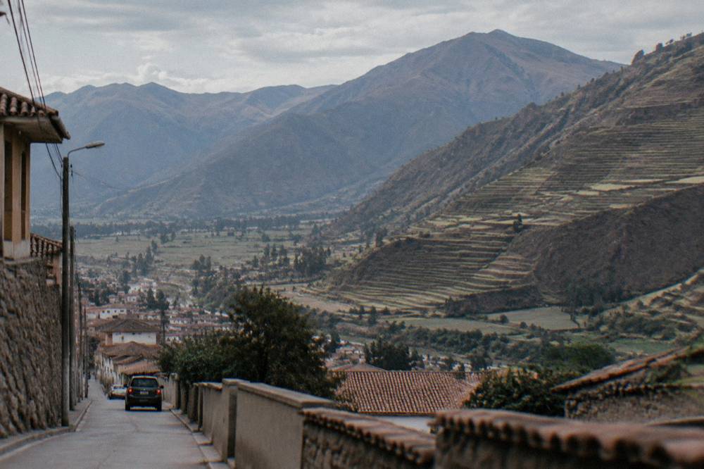
The Sacred Valley runs west and northwest of Cusco along the Urubamba river, with Pisac at 2,972 m, Urubamba at 2,870 m, Ollantaytambo at 2,792 m and Moray at 3,385 m, all of them lower than the city itself, which is why the valley is a common first stop while visitors acclimatise.
The valley's geography explains its role in every itinerary. Cusco sits on a high plateau; the valley drops away to the northwest, and its towns sit at elevations several hundred metres below the Plaza de Armas. The Boleto's Circuit III sites, Pisac, Ollantaytambo, Chinchero and Moray, are spread along it, with the Maras salt mines nearby (entry to the salt works is a separate community fee of about S/ 15 to 20). The Sacred Valley guide maps the whole route, and the question of staying in Cusco or the Sacred Valley has its own page.
Ollantaytambo matters twice on the map: it is a Boleto site in its own right, and it is the valley's rail hub, with trains to Machu Picchu taking about 1 h 45 from there, against about 4 h 30 from San Pedro station in Cusco and about 3 h 30 from Poroy, per the rail operator's own FAQ. In wet-season disruptions, when the Cusco-area track can be out of service, a bimodal bus-plus-train combination via Ollantaytambo is used. The Cusco to Ollantaytambo guide covers the connection in detail.
MINCETUR's dataset gives a sense of how the valley's sites rank: in 2025 the Ollantaytambo archaeological park recorded 891,526 visits, Moray 773,916 and Pisac 560,578. Those are entry counts, not unique visitors, but they confirm what any map suggests: the valley is the region's second pole after Machu Picchu. The full index of guides sits on Things To Do In Cusco Peru.
| Sacred Valley site | Elevation | Ticket | 2025 recorded visits |
|---|---|---|---|
| Pisac | 2,972 m | Boleto Circuit III | 560,578 |
| Urubamba | 2,870 m | No site ticket | Not a ticketed site |
| Ollantaytambo | 2,792 m | Boleto Circuit III | 891,526 |
| Moray | 3,385 m | Boleto Circuit III | 773,916 |
| Maras salt mines | 3,300 m | Separate fee, about S/ 15 to 20 | Not in the Boleto count |
Where Do The Mountain Day Trips Sit On The Cusco Map?
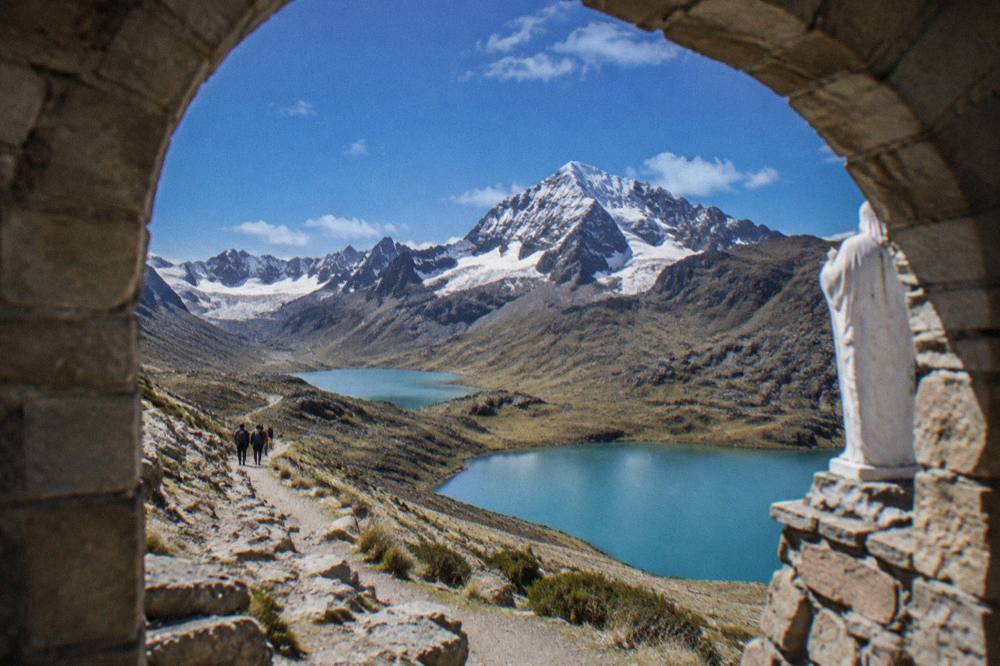
The mountain day trips radiate south and southeast of Cusco: Rainbow Mountain (Vinicunca) at about 5,000 m and the gentler Palccoyo alternative at 4,900 m lie to the southeast, Humantay Lake at about 4,200 m sits on the road toward the Salkantay massif, and the Ausangate seven lakes route reaches the high country southeast of the city, all of them reached by long road transfers.
These are the trips where the map matters most, because the distances are large and the elevation gains are severe. Vinicunca stands about 5,000 m, and peru.travel describes its highest point at roughly 5,200 m; the community entry fee for foreigners is S/ 25 to 30, paid in cash. Palccoyo, the lower alternative with a viewpoint at 4,900 m, carries a fee of about S/ 20 and a shorter walk, a comparison this site sets out in the Rainbow Mountain versus Palccoyo guide.
Humantay Lake sits at about 4,200 m on the way toward the Salkantay trailhead, and sources disagree on its entry fee, quoting figures between S/ 10 and S/ 20, so this page prints no single number. The Ausangate seven lakes trek and the Waqrapukara complex push further into the high puna southeast and south of the city; Waqrapukara charges either no ticket or a small community contribution. All of these trips involve hours of driving each way on mountain roads, which is why nearly every visitor goes with an organised day tour rather than self-driving.
The elevation order is worth memorising against the map: Cusco at 3,335 m, Humantay at about 4,200 m, Palccoyo at 4,900 m, Vinicunca at about 5,000 m. The CDC Yellow Book advises a graded ascent wherever possible, and names Cusco as a rapid-ascent destination. A day in the city before any mountain day trip is not padding; it is the acclimatisation the health guidance points to.
| Mountain day trip from Cusco | Direction | Elevation | Entry fee |
|---|---|---|---|
| Humantay Lake | Toward Salkantay | About 4,200 m | S/ 10 to 20, sources differ |
| Palccoyo | Southeast | 4,900 m viewpoint | About S/ 20 |
| Rainbow Mountain (Vinicunca) | Southeast | About 5,000 m | S/ 25 to 30, cash |
| Ausangate seven lakes | Southeast | High puna | Included in tours |
| Waqrapukara | South | High puna | No ticket or small contribution |
How Do The Trains And Roads Out Of Cusco Work On The Map?
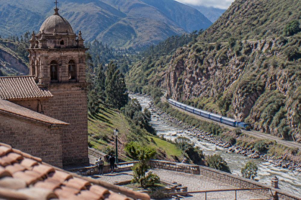
Cusco connects outward by two rail lines, both run by PeruRail and Inca Rail toward Machu Picchu Pueblo, and by road in every direction: the Sacred Valley road northwest, the Puno road southeast across the altiplano, and the airport road to Alejandro Velasco Astete, which handles every Cusco flight while the new Chinchero airport remains under construction.
The rail map is simpler than it looks. Two Cusco-area stations exist, San Pedro close to the centre and Poroy on the city's outskirts, plus the Ollantaytambo hub in the valley, and the end of the line is Aguas Calientes, the town below Machu Picchu at about 2,040 m, from which a bus road climbs to the citadel at 2,430 m. The rail operator's FAQ gives the journey times: about 4 h 30 from San Pedro, about 3 h 30 from Poroy and about 1 h 45 from Ollantaytambo. The Cusco to Machu Picchu train is a topic ceded to a sibling site, so this page stops there.
By road, the map fans out. The Sacred Valley route drops northwest from the city toward Chinchero, Maras and Moray before reaching Urubamba and Ollantaytambo. The southeast road climbs onto the altiplano toward Puno, a bus journey of about 389 km and roughly 6 hours, and scenic Route of the Sun day trips cover it in one direction. The getting around Cusco guide handles the city's own transport.
The airport sits about 6 km from the Plaza de Armas, 15 to 20 minutes by taxi, with an airport taxi to the centre reported at about S/ 15 to 25. The new international airport at Chinchero is not operating: reported progress stood at about 38.9 percent in mid-2026, with completion targeted for 2028 and flights expected 2028 to 2029, so every Cusco flight uses Alejandro Velasco Astete for now. The Cusco airport guide covers arrivals in full.
| Route from Cusco | Mode | Typical journey time | Source |
|---|---|---|---|
| Airport to Plaza de Armas | Taxi | 15 to 20 minutes | peru.travel |
| San Pedro station to Machu Picchu | Train | About 4 h 30 | Rail operator FAQ |
| Poroy station to Machu Picchu | Train | About 3 h 30 | Rail operator FAQ |
| Ollantaytambo to Machu Picchu | Train | About 1 h 45 | Rail operator FAQ |
| Cusco to Puno | Bus | About 6 hours | peru.travel |
| Lima to Cusco | Flight | About 1 h 15 | peru.travel |
When Should You Use The Cusco Map, And When Should You Leave It?
The Cusco map rewards two kinds of days: acclimatisation days spent inside the compact historic centre, when the steep streets themselves are the attraction, and clear dry-season days from May to September, when the mountain roads and viewpoints are at their most reliable, while the wet months from December to March carry 71.9 percent of the year's rain and are better for city museums than high trails.
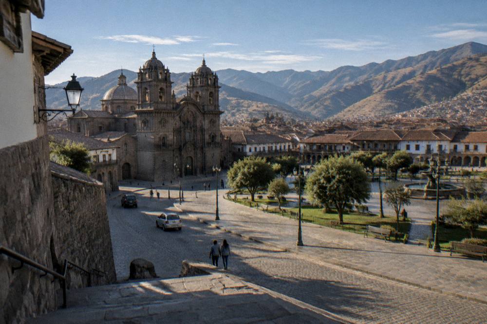
The rhythm of a Cusco trip usually writes itself from the map. The first day belongs to the centre: the Plaza de Armas, the Qorikancha site museum, the twelve-angled stone, San Blas, and a slow climb toward Saqsaywaman if the legs allow, all inside a walkable radius. The Boleto's Circuit I and II sites fill exactly this radius. The second and third days reach outward to the Sacred Valley, which sits lower than the city and makes a gentle second step, and only then do the high mountain days follow.
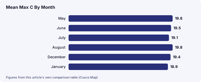
The climate table explains the calendar. The WMO/SENAMHI historical normal for the Cuzco station shows mean daily maximums between 18.8 and 20.9 C in every month of the year, but the rain is wildly seasonal: December to March delivers 508.7 mm of the annual 707.8 mm, while May to August together bring just 22.8 mm. June and July nights are cold, with frost common, yet the days stay clear. The Cusco weather by month guide carries the full table, and the best time to visit Cusco guide turns it into planning advice.
Crowds follow the same pattern. MINCETUR's monthly figures for Machu Picchu in 2025 show October drawing 154,105 visitors against February's 79,806, nearly twice as many, and the dry-season months of June through September all sit high in the table. The monthly visitor figures on this site's home page track the same seasonality. For festival planning, Inti Raymi fills the Plaza de Armas and the Saqsaywaman explanada every 24 June, a date the Inti Raymi guide covers, and a Pope Leo XIV visit scheduled for Sacsayhuaman on 15 November 2026 is expected to bring crowding and access control around the site.
| Month | Mean max C | Mean min C | Rain mm |
|---|---|---|---|
| May | 19.8 | 2.5 | 8.7 |
| June | 19.5 | 0.3 | 1.5 |
| July | 19.1 | 0.1 | 4.0 |
| August | 19.8 | 1.6 | 8.6 |
| December | 19.4 | 6.4 | 122.7 |
| January | 18.9 | 6.6 | 145.3 |
For everything the map cannot show, the practical guides fill the gaps: what to eat in Cusco, is Cusco safe, free things to do in Cusco and Cusco with kids all work from the same geography described here. The short version of the whole map is this: one plaza, four hills, one valley to the northwest, mountains to the south, and a rail line to the one site everyone is here for.
Common Questions About The Cusco Map
Is Cusco Walkable Without A Map?
The historic centre is compact and walkable, with nearly every central site within a short, steep walk of the Plaza de Armas, so it is easy to get oriented within a day. The hills to the north, including the climb to Saqsaywaman at 3,701 m, are demanding rather than long, and the day-trip destinations all require road or rail transport.
How Far Is Machu Picchu From Cusco On The Map?
Machu Picchu is not in Cusco. The citadel sits at 2,430 m, lower than the city at 3,335 m, and is reached by train to Aguas Calientes at about 2,040 m, taking about 4 h 30 from San Pedro station, about 3 h 30 from Poroy or about 1 h 45 from Ollantaytambo, followed by a bus climb to the site.
Which Direction Is The Sacred Valley From Cusco?
The Sacred Valley lies west and northwest of the city along the Urubamba river, and its towns sit lower than Cusco: Pisac at 2,972 m, Urubamba at 2,870 m and Ollantaytambo at 2,792 m. The Boleto's Circuit III covers the valley's main archaeological sites.
Do You Need A Car In Cusco?
No. The centre is walkable, taxis are inexpensive, and the day trips are almost always done by organised tour or public transport. An airport taxi to the centre is reported at about S/ 15 to 25, and the airport sits about 6 km from the Plaza de Armas.
What Is The Highest Point Near Cusco On The Day-Trip Map?
Rainbow Mountain, Vinicunca, stands about 5,000 m, with peru.travel describing the highest point at roughly 5,200 m, making it the highest of the standard day trips. Palccoyo's viewpoint is lower at 4,900 m, and Humantay Lake sits at about 4,200 m.
Where Is The New Chinchero Airport On The Map?
Chinchero lies in the Sacred Valley northwest of the city, but the new international airport there is not operating: reported progress was about 38.9 percent in mid-2026, with completion targeted for 2028. Every Cusco flight currently uses Alejandro Velasco Astete airport, about 6 km from the Plaza de Armas.