Where Is Cusco?
Cusco is a city in the Andes of southern Peru, the historic capital of the Inca empire, sitting at 3,335 m above sea level in the Cusco region. This guide places it on the map, explains the altitude, the seasons and the routes in.
Short answer
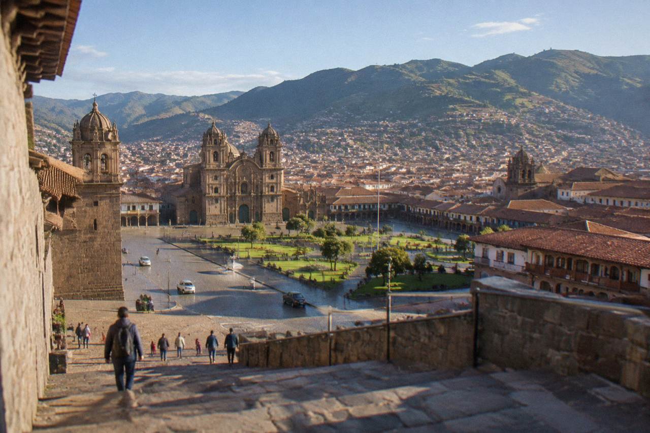
Cusco is in the Andes of southern Peru, in the Cusco region, at about 3,335 m above sea level. It is roughly 1 h 15 by air from Lima and is the usual gateway to Machu Picchu and the Sacred Valley.
Cusco is a city in the Andes of southern Peru, the historic capital of the Inca empire, and the gateway to Machu Picchu and the Sacred Valley. The Plaza de Armas, its old centre, sits at 3,335 m above sea level according to PromPeru, the country's official tourism board. UNESCO inscribed the City of Cusco on the World Heritage List in 1983, the same year the Machu Picchu sanctuary joined it. The spelling "Cuzco" is the older alternative and appears on some maps and climate records; "Cusco" is the spelling used across this site.
That single paragraph answers the headline question, but the location raises more questions than it settles. The altitude shapes everything a visitor does here, the seasons run opposite to Europe and North America, and the city's position on the Andean spine determines how every train, bus and flight arrives. For the wider picture of what the city offers, the Things To Do In Cusco Peru homepage collects the full range of activities, tours and day trips.
Where Is Cusco On The Map Of Peru?
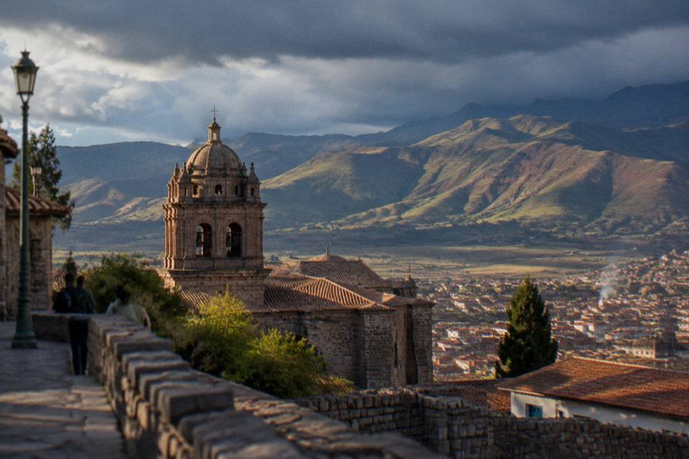
Cusco lies in the Andes of southern Peru and is the capital of the Cusco region, a department that stretches from high mountain grassland down into Amazonian cloud forest. The city itself sits in a mountain basin at 3,335 m, roughly in the centre of its own region, and about 1 h 15 by air from Lima, the national capital on the Pacific coast.
Peru sits on the Pacific side of South America, and Cusco sits well inland from that coast, high on the eastern slope of the Andes. The Cusco region is one of the country's larger departments and contains a striking range of elevations within a short distance of the city. The 2017 census counted 1,205,527 residents in the Cusco department and 428,450 in the city itself, figures published by INEI, the national statistics institute. No newer official count exists, so those are the numbers this site uses.
The city's position explains its role in Peruvian travel. It is the transport hub for the Sacred Valley, the Inca Trail and Machu Picchu, all of which lie at lower or more distant points around it. Pisac sits at 2,972 m, Ollantaytambo at 2,792 m, Urubamba at 2,870 m and Moray at 3,385 m, all of them valley towns below or near the city's own height. The Machu Picchu citadel is at 2,430 m, and the town of Aguas Calientes below it at about 2,040 m. In other words, almost every famous destination in the region is reached by descending from Cusco, not climbing above it.
The Ministry of Culture's ticket platform and the COSITUC ticket office in the city together administer nearly all of these sites, which is one reason travellers base themselves here rather than in the valley. The trade-off between a city base and a valley base has its own analysis at where to stay in Cusco, and the altitude implications are covered at Cusco altitude.
| Place | Elevation (m) | Relation to Cusco |
|---|---|---|
| Cusco, Plaza de Armas | 3,335 | The city itself |
| Cusco airport | 3,310 | The city's airport |
| Sacsayhuaman | 3,701 | Hill site above the city |
| Pisac | 2,972 | Sacred Valley town |
| Moray | 3,385 | Inca terraces in the valley |
| Urubamba | 2,870 | Sacred Valley town |
| Ollantaytambo | 2,792 | Valley town and rail hub |
| Machu Picchu citadel | 2,430 | The famous site, lower than Cusco |
| Aguas Calientes | 2,040 | Town below Machu Picchu |
How High Is Cusco, And Why Does The Altitude Matter?
Cusco's Plaza de Armas sits at 3,335 m above sea level, and the CDC Yellow Book names the city as a high-altitude destination at approximately 3,350 m where travellers arriving by air ascend rapidly. The CDC advises a graded ascent where possible and notes that travellers can descend to lower elevations to sleep for the first night or two before climbing higher.
Altitude is the single fact that most changes a first visit. The CDC Yellow Book advises avoiding a move from low altitude to a sleeping altitude of 2,750 m or more in a single day where that is feasible, and once above 3,000 m, increasing sleeping altitude by no more than 500 m per night with an extra night allowed for every 1,000 m gained. A flight from Lima, at sea level, to Cusco compresses that ascent into about 1 h 15, which is why the CDC names Cusco among destinations where abrupt ascent is the norm. The same source notes that rates of altitude illness approach 50 percent in rapid-ascent situations where staged acclimatisation is not feasible, and that a low threshold for considering preventive medication is therefore advised. Acetazolamide is a prescription decision to make with a doctor, not something to buy at a pharmacy counter on arrival.
The practical reading of all this is that the first day in Cusco should be gentle. The city rewards slow wandering anyway: the Plaza de Armas, the Qorikancha museum, San Pedro Market and the lanes of San Blas are all flat-to-gentle walking, and an acclimatisation day spent on them serves two purposes at once. The CDC also advises avoiding alcohol for the first 48 hours at high altitude. A cup of coca tea is a common welcome in the city, reported at about S/ 2 to 5, though the CDC makes no claim about its effect.
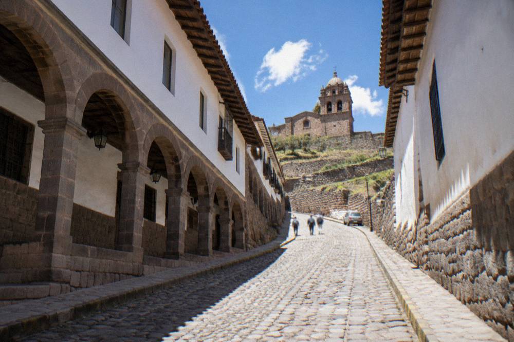
A food-focused walk is one of the better first-day formats, because it keeps the pace slow and the stops frequent. The cooking classes and market tours page covers the options in depth.
The related tour above, a cooking class paired with the San Pedro Market, fits the first day well: the market sits in the historic centre and the class runs at an easy pace. Its price, rating and schedule render from the listing itself, so check the live card for current figures.
How Do You Get To Cusco?
Almost every traveller reaches Cusco by air into Alejandro Velasco Astete International Airport, about 6 km from the Plaza de Armas, on a flight of about 1 h 15 from Lima. There are no nonstop flights from the United States in 2026 schedules; itineraries connect through Lima. By road, the bus from Lima takes about 21 to 26 hours.
To compare fares into Alejandro Velasco Astete for your dates, book a flight to Cusco here.
The airport story is the main one. Alejandro Velasco Astete, at 3,310 m, handles all commercial flights into the city, and the much-discussed new airport at Chinchero is not operating: reported progress stands at about 38.9 percent as of mid-2026, with completion targeted for 2028 and flights expected in 2028 to 2029. Until then, everything lands at Velasco Astete. The Cusco airport guide covers arrival logistics in detail, including the transfer options; an airport taxi to the centre is reported at about S/ 15 to 25, and a private transfer can be booked ahead. The flight from Lima is short, but the altitude jump it delivers is not, which ties every arrival back to the CDC advice above.
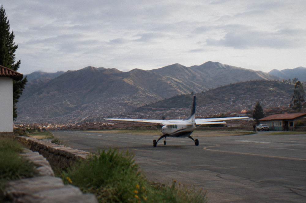
Overland arrival is slower but real. The bus from Lima takes about 21 to 26 hours, and the scenic route toward Puno, further south, runs about 389 km and roughly 6 hours by bus. The train network is a different matter again: PeruRail and Inca Rail both operate from the Cusco area toward Machu Picchu, with services from the San Pedro and Poroy stations and from Ollantaytambo. PeruRail's own FAQ gives the journey times: San Pedro to Machu Picchu takes about 4 h 30, Poroy about 3 h 30, and Ollantaytambo about 1 h 45. In wet-season disruptions a bimodal service, bus to Ollantaytambo then train, replaces the Cusco-side leg. The Cusco to Machu Picchu train is covered in depth on a sister site, so this page keeps it to that summary.
| Route | Mode | Time |
|---|---|---|
| Lima to Cusco | Flight | About 1 h 15 |
| Lima to Cusco | Bus | About 21 to 26 hours |
| Cusco airport to Plaza de Armas | Taxi | 15 to 20 minutes |
| San Pedro station to Machu Picchu | Train | About 4 h 30 |
| Poroy station to Machu Picchu | Train | About 3 h 30 |
| Ollantaytambo to Machu Picchu | Train | About 1 h 45 |
| Cusco to Puno | Bus | About 6 hours over 389 km |
Getting around once in the city is its own topic, covered at getting around Cusco, and the valley leg to the main rail hub is covered at Cusco to Ollantaytambo.
What Sits Around Cusco?
Cusco is ringed by Inca and colonial sites within a short radius: Sacsayhuaman, Q'enqo, Puka Pukara and Tambomachay on the hills above the city, the Sacred Valley towns of Pisac, Ollantaytambo, Urubamba, Chinchero, Maras and Moray to the north and west, and high mountain destinations such as Rainbow Mountain and Humantay Lake beyond them.
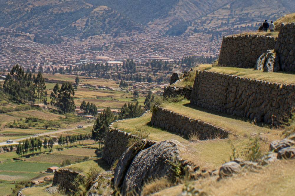
The hills immediately above the city hold four archaeological sites, all covered by the Boleto Turistico's Circuit I. Sacsayhuaman, at 3,701 m, is the largest of them; the esplanade there recorded 944,008 visits in 2025 in the MINCETUR open dataset, the third-highest figure of any site in the region after Machu Picchu itself. The valley to the north holds the rest: Pisac recorded 560,578 visits, the Ollantaytambo archaeological park 891,526 and Moray 773,916 in the same dataset. Those numbers describe entries, not unique people, but they give a fair picture of where the crowds actually go.
Further out, the map climbs again. Vinicunca, the Rainbow Mountain, stands at about 5,000 m, with the community entry fee for foreigners at S/ 25 to 30 paid in cash. Palccoyo, the quieter alternative, reaches a viewpoint at 4,900 m with a fee of about S/ 20. Humantay Lake sits at about 4,200 m, with sources disagreeing on the entry fee, reported between S/ 10 and S/ 20. The comparison between the two rainbow mountains is worked through at Rainbow Mountain versus Palccoyo.
| Cusco-region site | 2025 visits (MINCETUR) |
|---|---|
| Santuario Historico de Machupicchu | 1,542,350 |
| Ciudad Inka de Machupicchu | 1,479,506 |
| Explanada de Saqsaywaman | 944,008 |
| Parque Arqueologico de Ollantaytambo | 891,526 |
| Moray | 773,916 |
| Pisaq | 560,578 |
Two of the region's most rewarding day formats start from the city. A quad bike run to the Moray terraces and the Maras salt mines covers the valley's most photogenic pair in a half-day, and the listing carries its own price and rating. A full-day Machu Picchu trip by panoramic train is the flagship excursion, and its figures likewise render from the live card.
For travellers who would rather start with the city itself, a market-and-cooking morning keeps everything within the historic centre, and the related tour on this page does exactly that. Check availability on the operator's live listing for current dates and prices.
Is Cusco The Same Place As Machu Picchu?
No. Cusco is the highland city at 3,335 m; Machu Picchu is an Inca citadel at 2,430 m, reached from Cusco by a combination of train and bus or by trek, roughly 900 m lower than the city. The two are linked by transport and by the Inca Trail, but they are separate places about a day of travel apart.
This confusion is common enough that this site carries a dedicated answer page on it, but the geography is simple. Machu Picchu is not in Cusco city and cannot be seen from it. The citadel sits on a ridge above the Urubamba river, with the town of Aguas Calientes in the gorge below at about 2,040 m. The Inca Trail, the famous trek, approaches Machu Picchu on foot over several days under a permit system capped at 500 people per day including porters and guides, sold only through licensed agencies and closed every February. The citadel's own entry is a separate ticket sold on the Ministry of Culture's platform, and a guide is recommended but not mandatory under the rules in force since September 2026.
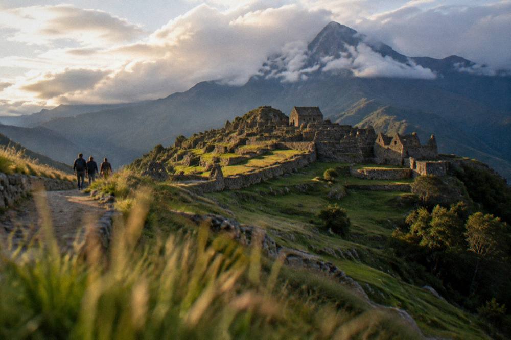
The practical point for planning is that Cusco is the base and Machu Picchu is the excursion. Most itineraries spend at least a night or two in the city first, partly for the acclimatisation the CDC advises and partly because the train connections run through the city's stations or Ollantaytambo. The question of which to see first, the valley or Machu Picchu, has its own answer page, and the choice of where to sleep the night before is covered at where to stay in Cusco.
What Is The Weather Like Where Cusco Sits?
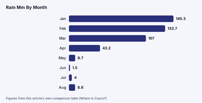
Cusco has a Southern Hemisphere high-Andes climate: a dry season roughly May to September with clear days, cold nights and frost in June and July, and a wet season roughly November to March, with December to March delivering 71.9 percent of the year's 707.8 mm of rain. Mean daily maximums stay between 18.8 and 20.9 C all year.
The seasons invert relative to Europe and North America, which is the detail that catches out the most planners. June to August is winter here: dry, brilliantly clear in the daytime, and cold enough at night for frost, with mean minimums of 0.3 C in June and 0.1 C in July at the WMO/SENAMHI "Cuzco" station. The same historical normal shows the daytime maximum barely moving across the year, from 18.8 C in February to 20.9 C in October. The rain, by contrast, is heavily concentrated: December, January, February and March together deliver 508.7 mm of the annual 707.8 mm, while May to August bring just 22.8 mm between them.
| Month | Mean max C | Mean min C | Rain mm |
|---|---|---|---|
| Jan | 18.9 | 6.6 | 145.3 |
| Feb | 18.8 | 6.5 | 133.7 |
| Mar | 19.1 | 6.2 | 107.0 |
| Apr | 19.7 | 4.9 | 43.2 |
| May | 19.8 | 2.5 | 8.7 |
| Jun | 19.5 | 0.3 | 1.5 |
| Jul | 19.1 | 0.1 | 4.0 |
| Aug | 19.8 | 1.6 | 8.6 |
| Sep | 19.8 | 3.9 | 21.8 |
| Oct | 20.9 | 5.5 | 39.4 |
| Nov | 20.7 | 6.1 | 71.9 |
| Dec | 19.4 | 6.4 | 122.7 |
Those figures are a historical normal supplied by SENAMHI, Peru's weather service, to the World Meteorological Organization's city records; the averaging period is not stated on the record, so it is not labelled here as a 1991-2020 normal. The month-by-month detail, including what each season means for treks and mountain day trips, is worked through at Cusco weather by month, and the timing verdict sits at the best time to visit Cusco.
The wet season is not a write-off. The MINCETUR dataset shows Machu Picchu's 2025 visitor numbers swinging from 79,806 in February to 154,105 in October, a factor of about 1.93, which says most people choose dry season. What the data does say is that the region's sites stay busy year-round: the sum of recorded entries across the Cusco department's listed sites reached 10,704,938 in 2025.
Where Should You Stay Once You Are In Cusco?
Most first-time visitors stay in Cusco's historic centre, the colonial grid around the Plaza de Armas, or in San Blas on the hill to its east, both of which keep the main sites, restaurants and tour departure points within walking distance; the Sacred Valley towns are the main alternative for longer itineraries.
The city's neighbourhoods are compact. The historic centre holds the Cathedral, the Qorikancha museum and the lanes of Inca stonework; San Blas climbs above it with the artisans' quarter and viewpoints; Sacsayhuaman and Cristo Blanco stand on the hills to the north. The Cusco historic centre and San Blas pages describe each in detail, and the practical shortlist, from budget hostels to the established hotels, sits at the best hotels in Cusco.
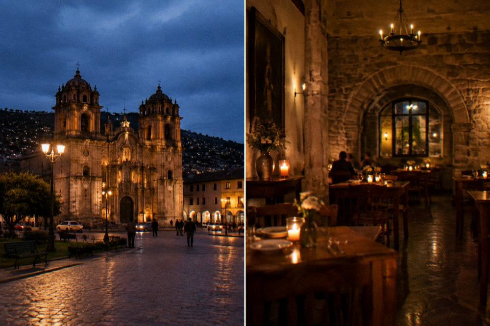
The evenings in the centre are part of the location's appeal. The food scene runs from market stalls to recognised restaurants, and the Michelin Guide does not list restaurants anywhere in Peru, so the reliable signals are the local lists, covered at the best restaurants in Cusco and what to eat in Cusco. Nightlife has its own page at Cusco nightlife, and the question of whether the city is safe to explore after dark is answered at is Cusco safe.
A cooking class with a market tour remains one of the most location-efficient ways to spend a first evening or a slow morning, since everything happens within a few blocks of the Plaza de Armas, and the related tour's live listing carries the current dates and prices.
Common Questions About Where Cusco Is
Where Is Cusco?
Cusco is a city in the Andes of southern Peru, the capital of the Cusco region. Its Plaza de Armas sits at 3,335 m above sea level. It is about 1 h 15 by air from Lima and is the standard base for reaching Machu Picchu and the Sacred Valley.
Is Cusco In The Mountains?
Yes. Cusco sits in a high Andean basin at 3,335 m, with the hill site of Sacsayhuaman at 3,701 m directly above it and mountain destinations such as Rainbow Mountain, at about 5,000 m, further out in the region.
Is Cusco The Same As Machu Picchu?
No. Cusco is the city at 3,335 m; Machu Picchu is an Inca citadel at 2,430 m, roughly 900 m lower, reached by train and bus or by trek. The citadel is a separate place with its own entry ticket.
Which Country Is Cusco In?
Peru. Cusco lies in the country's south, inland from the Pacific coast, in the Cusco region. The 2017 census counted 428,450 people in the city and 1,205,527 in the region.
How Far Is Cusco From Lima?
The flight from Lima to Cusco takes about 1 h 15. By bus the journey takes about 21 to 26 hours. There are no nonstop flights from the United States to Cusco in 2026 schedules; itineraries connect through Lima.
Is Cusco Higher Than Machu Picchu?
Yes. Cusco's Plaza de Armas is at 3,335 m and the Machu Picchu citadel at 2,430 m, so the city sits roughly 900 m higher. The town of Aguas Calientes below the citadel is at about 2,040 m.
The location, in the end, is the itinerary. A city at 3,335 m in the southern Andes, one hour and a quarter from the coast by air, ringed by Inca sites and sitting above the valley that leads to the continent's most famous ruin: nearly every plan for this region is just a consequence of that geography.