Cusco Viewpoints And Photo Spots
Cusco is a city built for looking: a historic centre at 3,335 m ringed by hills, terraces and white statues, with viewpoints that cost nothing except the walk up.
Short answer
The best views in Cusco cluster on the hills north and east of the Plaza de Armas: the Sacsayhuaman terraces, the Cristo Blanco statue, the San Blas steps and the rooftop walkways around the cathedral, all reachable on foot from the historic centre.
Cusco sits in a high Andean basin at 3,335 m, and the city's own geography is what makes its viewpoints work: the historic centre fills a shallow valley floor, and the hills to the north and east rise steeply enough that a short climb turns the red rooftops, the cathedral towers and the plaza into a single framed photograph. The Inca built terraces and ceremonial sites on those same hills, which is why so many of the best photo spots in Cusco are also archaeological sites on the Boleto Turistico. This guide walks through the viewpoints that are actually worth the climb, what each one shows, what a ticket costs where a ticket applies, and how the southern-hemisphere light and weather shape the pictures you come home with. Things To Do In Cusco Peru covers the wider city, from altitude planning to where to stay.
Where Are The Best Views In Cusco?
The best views in Cusco sit on the hills immediately north and east of the Plaza de Armas: the Sacsayhuaman terraces at 3,701 m, the Cristo Blanco statue beside them, the San Blas streets and steps on the eastern hill, and the rooftop lookouts around the cathedral and the historic centre. Every one of them is reachable on foot from the plaza, and only Sacsayhuaman itself asks for a Boleto Turistico ticket.
That short list is the practical answer, but the reason behind it is worth understanding. Cusco's centre is compact, and the hills around it are steep, so the city delivers a full sweep of rooftops, domes and mountains from a climb of only a few hundred metres of elevation gain. The trade-off is altitude: at 3,335 m the walk up from the plaza to Sacsayhuaman is a real effort, and the acclimatisation advice on this site matters before any of these climbs. The other trade-off is light. Cusco's dry season, roughly May to September, brings clear days and cold nights, while the wet season, roughly November to March, carries most of the year's rain, so the same viewpoint can deliver a blue-sky panorama in July and a cloud-wrapped one in January.
Here is how the main viewpoints compare, using the figures the verified facts on this site hold for each place:
| Viewpoint | What it shows | Elevation on record | Ticket |
|---|---|---|---|
| Sacsayhuaman terraces | The whole city basin, terraces up close, hills beyond | 3,701 m | Boleto Turistico Circuit I, S/ 70 partial or S/ 130 integral |
| Cristo Blanco | A framed panorama of the city with the statue in the foreground | Not separately recorded | None stated in the pack |
| San Blas streets and steps | Rooftops, church towers, the plaza below from the eastern hill | Not separately recorded | None |
| Plaza de Armas itself | Cathedral, colonnades, the Jesuit church, people | 3,335 m | Free public space |
| Qorikancha site museum area | Inca walls and the Santo Domingo church above them | City level | Boleto Turistico Circuit II |
The Boleto Turistico detail matters more than many travelers realize. COSITUC, the body that runs the ticket, sells it in person only, at the counter on Av. El Sol 103, open daily 07:30 to 18:00, and at most included sites. There is no online sale. The integral ticket for a foreign adult is S/ 130, about US$38, and is valid for 10 days; the partial circuit covering Sacsayhuaman, Q'enqo, Puka Pukara and Tambomachay is S/ 70, about US$20. The full breakdown, including the student price and the validity of each circuit, is on the Boleto Turistico guide.
Which Plaza De Armas Photo Spots Work Best, And When?
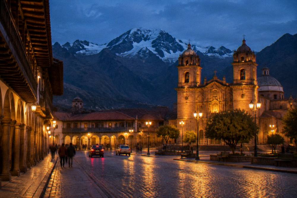
The Plaza de Armas itself is the single most photographed spot in Cusco, and the two practical angles are the square at ground level with the cathedral and the Jesuit church framing the shot, and the raised view over the rooftops from the streets climbing toward San Blas. The square is a free public space at 3,335 m, and the light is best in the morning before the afternoon cloud builds.
The plaza is the old centre of the city, the point from which the site's place records measure everything else. Colonial churches stand on Inca stone foundations here, a widely documented qualitative fact the pack allows, and the square's colonnades give shade and foreground for most of the day. Photographically the plaza rewards patience more than effort: the cathedral facade faces the square, the fountain anchors the centre, and the surrounding hills appear behind the roofline from several corners.
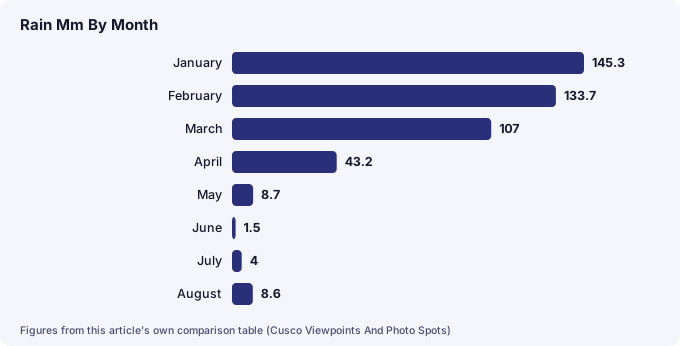
The practical planning question is timing, and that is where the climate record earns its place. Cusco's weather at the WMO/SENAMHI "Cuzco" station, a historical normal, splits the year hard: December to March delivers 508.7 mm of the year's 707.8 mm of rain, 71.9 percent, while May to August together bring just 22.8 mm. In the dry season the mornings are reliably clear and the nights are cold, with the mean July minimum at 0.1 C and frost nights common in June and July. In the wet season the mornings are often usable before the afternoon rain arrives. The month-by-month numbers are on the Cusco weather by month page.
| Month | Mean max C | Mean min C | Rain mm | Photo outlook |
|---|---|---|---|---|
| January | 18.9 | 6.6 | 145.3 | Wet season, morning windows |
| February | 18.8 | 6.5 | 133.7 | Wettest quarter, afternoon rain likely |
| March | 19.1 | 6.2 | 107.0 | Rains easing late month |
| April | 19.7 | 4.9 | 43.2 | Transition, greener hills |
| May | 19.8 | 2.5 | 8.7 | Dry season begins, cold nights |
| June | 19.5 | 0.3 | 1.5 | Clear days, frost at night |
| July | 19.1 | 0.1 | 4.0 | Clearest month, coldest nights |
| August | 19.8 | 1.6 | 8.6 | Clear, dry, cold mornings |
| September | 19.8 | 3.9 | 21.8 | Dry, warming slowly |
| October | 20.9 | 5.5 | 39.4 | Warmest mean maximum, some rain |
| November | 20.7 | 6.1 | 71.9 | Wet season returning |
| December | 19.4 | 6.4 | 122.7 | Wet, festive plaza in late month |
One Cusco-specific note for anyone photographing the plaza: the daily temperature swing is large, especially in winter. In July the mean maximum and minimum sit about 19 C apart, while in January the swing is about 12.3 C. That means a sunrise shoot in July is a genuinely cold standing-around job, and layers matter more than they do at midday, when the mean maximum stays between 18.8 and 20.9 C all year.
A city walking tour is the cheapest structured way to see these angles with someone who knows them, and the roster carries a well-reviewed option with local guides. The half-day city tour that includes the hillside ruins is the other strong fit for a first day, and both appear in the tour cards below.
What Do You See From Sacsayhuaman, And What Does The Viewpoint Cost?
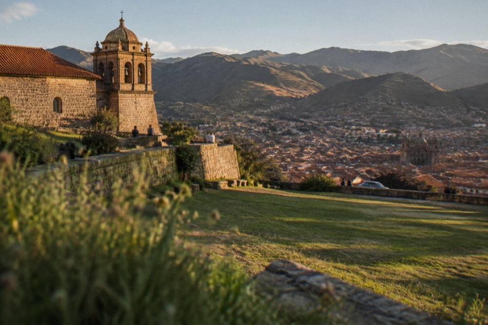
Sacsayhuaman, at 3,701 m on the hill north of the city, gives the widest panorama of Cusco: the full roofscape of the basin, the plaza area below, and the surrounding hills, seen from its terraces and its big open esplanade. Entry is on the Boleto Turistico, Circuit I at S/ 70 for a foreign adult, about US$20, or the S/ 130 integral ticket, and the site's listed hours are 07:00 to 18:00.
The site is the one headline Cusco viewpoint that is not free, and the ticket question decides the visit for many people. COSITUC's own tarifario and FAQ, which this site's research read directly, list Sacsayhuaman as the anchor of Circuit I, alongside Q'enqo, Puka Pukara and Tambomachay. The partial ticket for that circuit is S/ 70 and is valid for 1 day; the integral ticket, S/ 130, about US$38, covers all 16 sites on the boleto over 10 days. Children are free to age 9, and ages 10 to 17 pay the student price with ID. The counter is on Av. El Sol 103, daily 07:30 to 18:00, and the ticket is not sold online.
The MINCETUR open dataset gives a sense of how visited the site is: the Explanada de Saqsaywaman recorded 944,008 visits in 2025, one of the highest counts of any Cusco site after Machu Picchu itself. That esplanada is the photo spot: a wide grassed space between the terrace walls, with the city laid out below to the south. The site also matters to the festival calendar, since Inti Raymi each 24 June ends its main ceremony at Sacsayhuaman, a day when the esplanade fills with spectators; the Inti Raymi guide covers what that means for a visit.
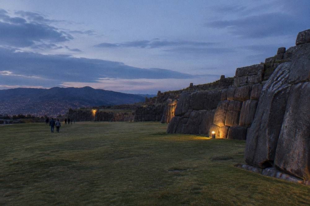
Between the plaza and Sacsayhuaman, the practical route question comes up constantly, and this site has a whole page on it. The walk is steep and the altitude is real, so the walking to Sacsayhuaman question is answered honestly there rather than glossed here. What the pack does hold is the geography: Sacsayhuaman and Cristo Blanco sit on the hills to the north of the centre, San Blas on the hill to the east. A guided half-day city tour that includes Sacsayhuaman and Q'enqo is the structured alternative to that walk, and it appears in the box below.
What Does Cristo Blanco Add To The Cusco Panorama?
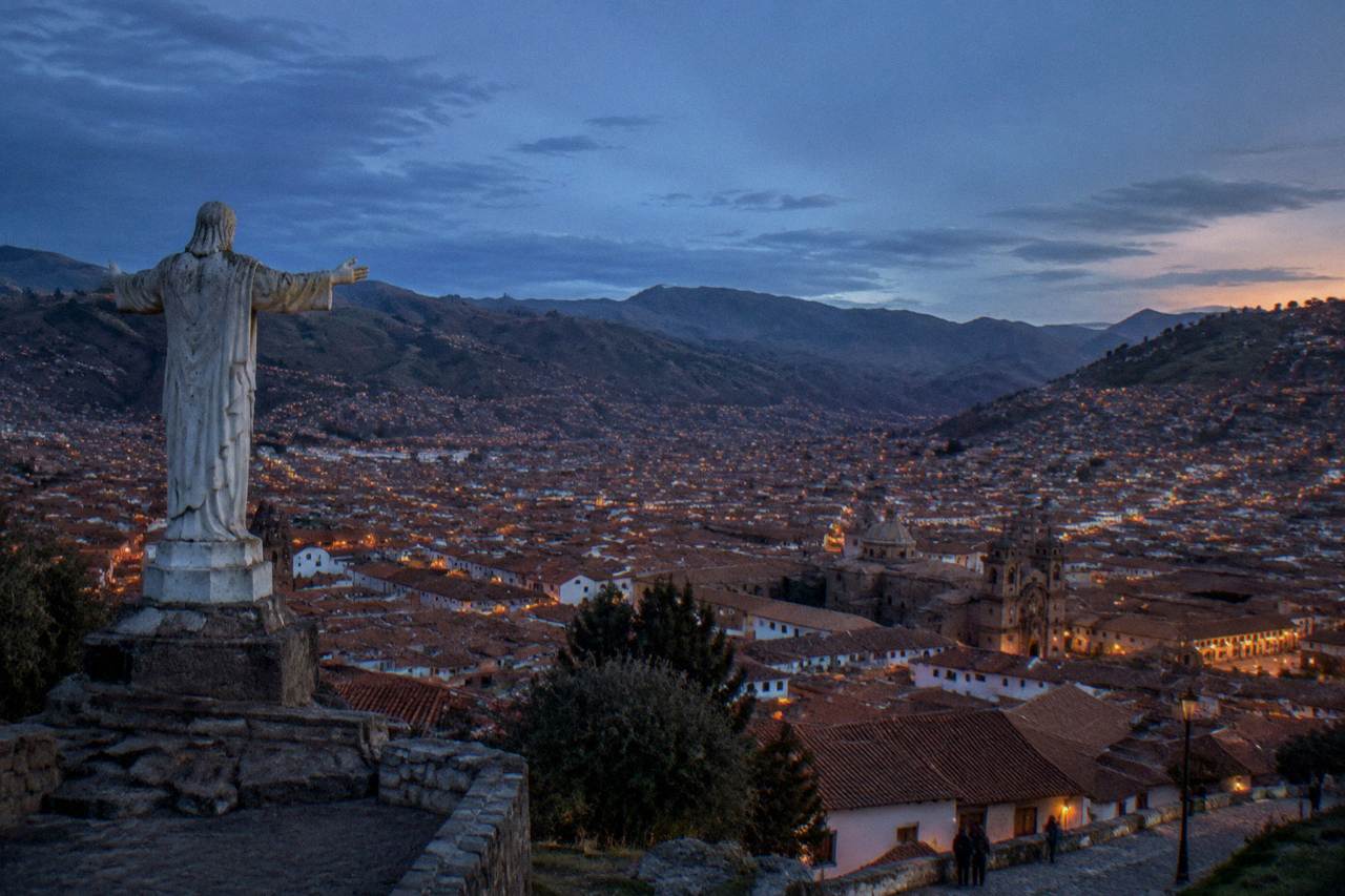
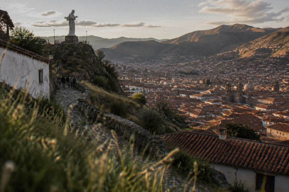
Cristo Blanco, the white statue on the hill north of the city beside the road toward Sacsayhuaman, gives the classic framed Cusco panorama: the statue's arched base in the foreground, the red roofs and church towers of the whole basin below, and the hills beyond. It is the single most recognisable foreground element in Cusco photography, and the pack holds no ticket or hours for it.
The statue works because of geometry rather than grandeur. It stands close enough to the city that the rooftops fill the lower frame, and its white shape against the sky gives a photo a subject when the panorama alone would be only a sea of terracotta. The view from the area takes in the plaza side of the basin, and in the dry season the clear June and July skies make the shot straightforward. In the wet season the same frame often carries cloud, which some photographers prefer for the drama, but the pack holds no sunshine figure for any Cusco viewpoint, so no promise is made here about which light is "best".
The honest planning notes are two. First, the climb to the statue is at altitude, on the same hill as Sacsayhuaman, so it belongs on the same day as the ruins rather than as a separate expedition. Second, the pack records a scheduled event that will affect this specific area: Pope Leo XIV is scheduled to visit Cusco and Sacsayhuaman on 15 November 2026, with a gathering at 10:30, so anyone photographing the hillside that week should expect crowding and access control around the esplanada. It is a scheduled event, not a certainty, but it is worth knowing before booking a November trip.
Why Do Photographers Head For San Blas?
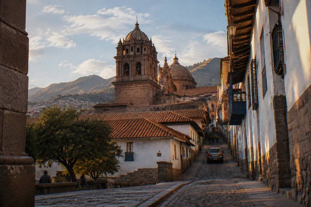
San Blas, the neighbourhood on the hill east of the Plaza de Armas, is where Cusco's most atmospheric street-level photos come from: narrow lanes, workshops, the church above the steps, and repeated framed views down over the rooftops toward the plaza. It is a public neighbourhood with no ticket, and its streets do the work that a single viewpoint cannot.
The neighbourhood's value to a photographer is that it offers dozens of small compositions rather than one big one. Every street that climbs east ends with the city behind you when you turn; every street that descends gives you the church and the hill ahead. The pack holds no founding date, no builder and no hours for the San Blas church, and none are needed: the reason to go is the fabric of the streets themselves. The site's San Blas guide covers the neighbourhood in full.
The practical warning is the one the UK Foreign Office travel advice carries for Peruvian cities: street crime is a significant problem in major cities including Cusco, and the advice is not to walk alone in quiet areas or at night. San Blas streets are quiet after dark. The is Cusco safe page sets out the full picture, including the US advisory's Level 2 rating and the fact that Cusco city, the Sacred Valley, the Inca Trail and Machu Picchu sit outside the Do Not Travel areas. For photography, the working rule is simple: shoot San Blas in daylight, and head down to the lit plaza or a booked nightlife venue after.
Which Viewpoints Cost Nothing In Cusco?
The free viewpoints in Cusco are the Plaza de Armas itself, the San Blas streets and steps, the Cristo Blanco area, and the public stairways and miradors that thread the hillsides east of the centre. Only the archaeological sites above the city, Sacsayhuaman chief among them, sit behind the Boleto Turistico, so a full day of Cusco views can be done without a ticket.
The free things to do in Cusco page lists the wider set, but for a photographer the free shortlist is genuinely enough for two full days. A morning in the plaza, a climb through San Blas in the middle of the day, and a late afternoon walk toward the northern hills cover the city's three best light windows without spending a sol on entry. The one purchase worth making is time: the mean daily maximum stays between 18.8 and 20.9 C all year, so the walking is pleasant at almost any season, and the cold only bites at night and at sunrise in the June to August winter.
Here is the free-versus-ticket split in one table:
| Spot | Cost | What the ticket covers |
|---|---|---|
| Plaza de Armas | Free public space | Nothing to buy |
| San Blas streets | Free | Nothing to buy |
| Cristo Blanco area | No ticket in the pack | Nothing to buy |
| Sacsayhuaman | S/ 70 Circuit I, or S/ 130 integral | Terraces and esplanade, plus Q'enqo, Puka Pukara, Tambomachay on the same circuit |
| Qorikancha site museum | Boleto Turistico Circuit II, S/ 70 partial | Museo de Sitio Qorikancha plus the city museums on Circuit II |
| Rooftop restaurants and cafes | Price of a drink | Varies by business, no figure in the pack |
A free walking tour is a third way to cover these streets with a guide, and the roster carries several GuruWalk entries, which are free and tip based. The YANA walking tour of the historic centre, run by Yana Tour Operator, is one such GuruWalk walk, and there is no price to print because the model is tips. The free walking tours page explains how the tip model works, including the reported tip range for such walks.
To cover these streets with a guide at no fixed price, book a free historical walking tour here.
How Do The Ruins Above The City Change The View?
The four ruin sites above Cusco, Sacsayhuaman, Q'enqo, Puka Pukara and Tambomachay, sit on a line of hills that gives a sequence of descending views: the widest panorama at Sacsayhuaman, then closer, rockier and quieter sites further along, all on the same Boleto Turistico Circuit I ticket at S/ 70 for a foreign adult.
The four-ruins circuit is a standard half-day structure, and the four ruins of Cusco page covers it in detail. For a photographer the logic is simple: Sacsayhuaman is the panorama, Q'enqo is the carved rock and the shadow, Puka Pukara and Tambomachay are the quiet ones, where the site itself, not the city below, is the subject. The pack holds no hours for the three smaller sites, and none are invented here; Sacsayhuaman's listed 07:00 to 18:00 is the only schedule on record among them.
What the smaller sites offer is what the esplanada cannot: scale and stillness. The MINCETUR dataset shows the visitor counts concentrate heavily on Sacsayhuaman, so the further sites along the circuit are the ones where a camera can work without a crowd in the frame. The trade is the view: none of the three matches the big panorama, and a visit planned purely for city photos should weight its time accordingly.
Which Views Outside The City Are Worth Adding?
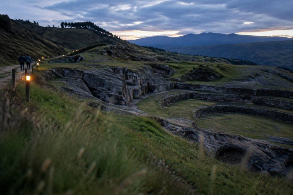
The views outside Cusco that justify the trip are the Sacred Valley sites, Pisac at 2,972 m, Ollantaytambo at 2,792 m, Moray at 3,385 m and the Maras salt mines at 3,300 m, all lower or near the city's own altitude, all on Boleto Turistico Circuit III except the salt mines, and all reachable on a full-day valley tour from the city.
The Sacred Valley is where Cusco's photography widens from rooftops to agricultural terraces and mountain walls. Pisac's terraces stack down the hillside in curves that read as pure geometry from the viewpoint above them; Ollantaytambo's fortress terraces climb the other way, toward the town below; Moray's concentric rings are unlike anything in the city. Circuit III of the boleto covers Pisac, Ollantaytambo, Chinchero and Moray at S/ 70 for a foreign adult, about US$20, valid for 2 days per the tarifario. The Maras salt mines are not on the boleto, and the reported entry is S/ 15 to 20, a secondary figure, so treat it as a range and check on arrival.
The salt mines and Moray pair well, and the roster's Sacred Valley tour covers both with a buffet lunch, one of the three tours in the cards below. The Sacred Valley guide and the Pisac, Ollantaytambo, Moray and Maras salt mines pages carry the site-by-site detail.
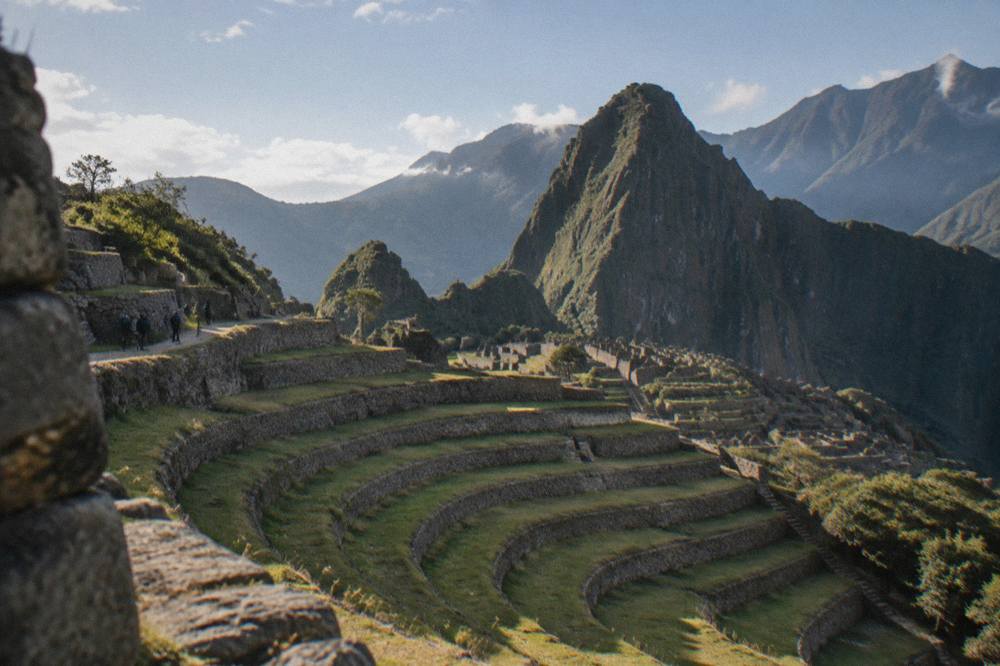
Beyond the valley, the mountain day trips change the register completely: Rainbow Mountain at about 5,000 m, Palccoyo at 4,900 m and Humantay Lake at about 4,200 m are high-altitude landscapes, not city views, and the pack holds no temperature or rainfall figure for any of them. The comparison between the two rainbow mountains, including the community fees, is on the Rainbow Mountain versus Palccoyo page.
What Light And Season Should You Plan Cusco Photos Around?
For Cusco photography, the dry season from May to September delivers the clearest light and the coldest nights, with July's mean minimum at 0.1 C against a 19.1 C mean maximum, while the wet season from November to March trades clear skies for greener hills and dramatic cloud, with 71.9 percent of the year's rain falling December to March. October reaches a 20.9 C mean maximum on record.
Those numbers come from the WMO World Weather Information Service station "Cuzco", supplied by SENAMHI, a historical normal rather than a 1991-2020 table, and they are the only sourced climate figures for the city. The planning consequences are concrete. A July sunrise shoot means temperatures around freezing at the viewpoint, with frost common in June and July, and a jacket that looks absurd by 10:00, when the sun has pushed the air toward the day's maximum. A January shoot means carrying rain protection and using the morning, because the afternoon belongs to the showers.
The crowd question follows the same calendar, and the MINCETUR open dataset shows the pattern at the region's biggest draw: Machu Picchu recorded 154,105 visits in October 2025 against 79,806 in February, a ratio of 1.93 to 1. Cusco's own hills are not counted month by month, so no equivalent claim is made for the viewpoints, but the same dry-season peak shapes every queue and every plaza. The best time to visit Cusco page weighs the whole trade-off, including the festival dates that put thousands of spectators on the Sacsayhuaman esplanada each 24 June.
Common Questions About Cusco Viewpoints And Photo Spots
Where are the best views in Cusco?
The best views in Cusco are on the hills north and east of the Plaza de Armas: the Sacsayhuaman terraces at 3,701 m, the Cristo Blanco statue beside them, the San Blas streets and steps, and the rooftop lookouts around the historic centre. All are reachable on foot from the plaza, and only Sacsayhuaman asks for a Boleto Turistico ticket.
Is Sacsayhuaman free to visit for the viewpoint?
No. Sacsayhuaman is on the Boleto Turistico, Circuit I, which costs S/ 70 for a foreign adult as a partial ticket or comes with the S/ 130 integral ticket. The ticket is sold in person at Av. El Sol 103, daily 07:30 to 18:00, and at most included sites, never online.
Can you walk from Cusco to the viewpoints?
Yes. The Plaza de Armas, San Blas and the Cristo Blanco area are all walking distance from the centre, though the climbs are steep at 3,335 m. Sacsayhuaman is also walkable, and the site's dedicated page on the walk covers the route and the effort honestly.
What time of day is best for photos in Cusco?
Mornings. The dry season, May to September, brings clear days and cold nights, and the mean daily maximum stays between 18.8 and 20.9 C all year, so midday is bright but harsh. In the wet season, November to March, the morning is the usable window before the afternoon showers.
Do you need a ticket for Cristo Blanco?
The verified facts on this site hold no ticket or hours for Cristo Blanco, so no price is stated. The statue stands on the hill north of the city beside the road toward Sacsayhuaman and gives a framed panorama over the rooftops.
Which viewpoints are good at night?
The Plaza de Armas is the lit, populated space after dark, and the UK Foreign Office advice for Peruvian cities is not to walk alone in quiet areas or at night, which rules the unlit hillside streets out as evening photo locations. A booked nightlife venue or a lit plaza corner is the practical evening option.
The last practical note belongs to the body, not the camera. Cusco's viewpoints are earned at altitude, and the CDC Yellow Book names Cusco as a rapid-ascent destination and prefers graded ascent, so the first day's photography is best done from the plaza and the lower San Blas streets, saving the northern hills for a day when the legs and the lungs agree. A chocolate workshop in the historic centre makes an easy first-day activity while the body adjusts, and the roster carries a well-reviewed one: Check availability. The cooking classes and what to eat in Cusco pages round out the slow-day options.
The workshop is one of the three tours gathered in the closing cards below, alongside the Sacred Valley salt-mines tour and the official Machu Picchu entrance ticket, so the full set of options can be compared in one place before any booking decision.
The trio below is the same comparison in card form, and it closes the set: a city-centre food workshop, a full Sacred Valley day with lunch, and the entrance ticket for the region's most famous view of all.