Sapantiana Aqueduct
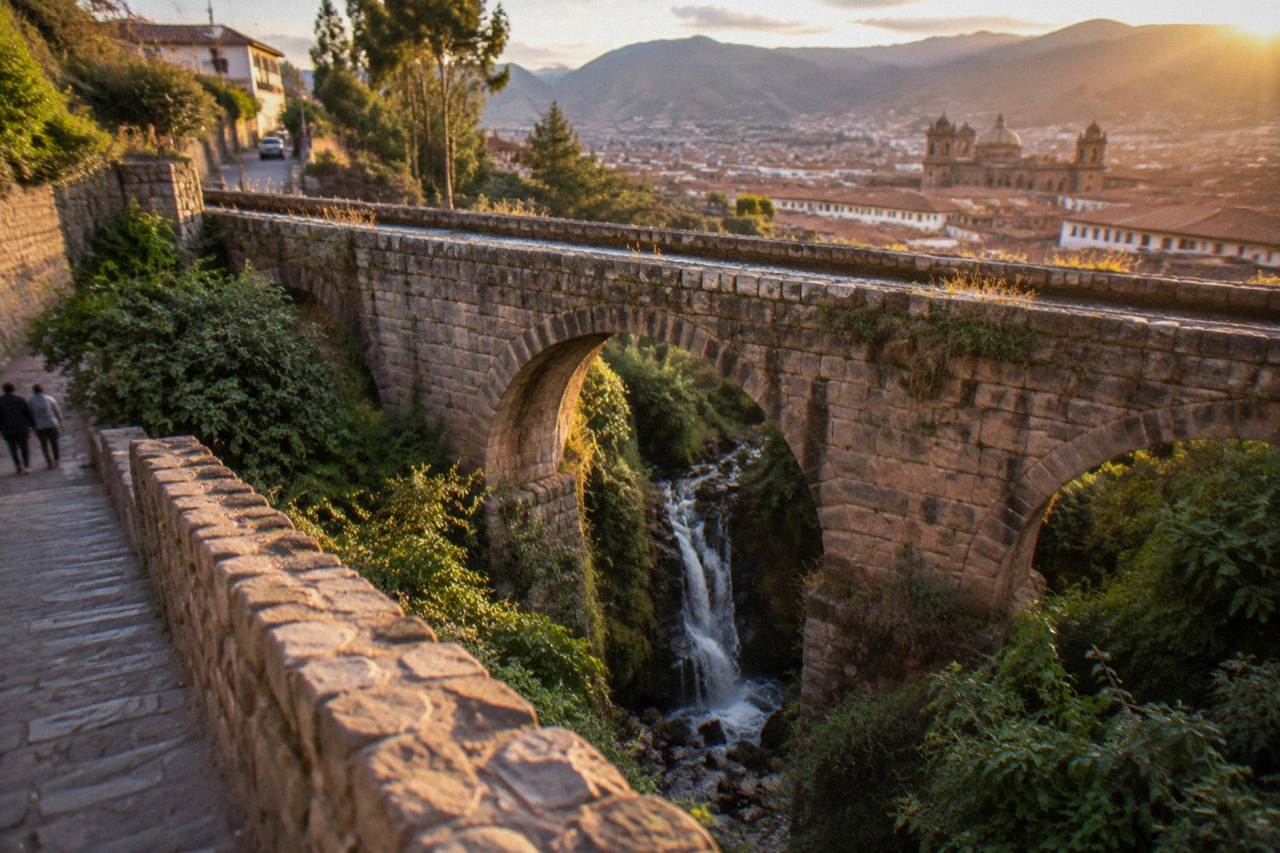
The Sapantiana Aqueduct is one of Cusco's quietest sights: a stone arch carrying a stream over a ravine on the hillside below San Blas, with a waterfall dropping beneath it. This guide covers what it is, how to reach it on foot, when to go, and what to combine it with.
Short answer
The Sapantiana Aqueduct is a stone arch aqueduct spanning a ravine on the hillside east of Cusco's Plaza de Armas, below the San Blas quarter. A stream crosses the arch and falls into the gorge beneath it, and the site is an open public space with no ticket, no booth and no posted hours, reached on foot from the historic centre.
Cusco, the historic city in the Andes of southern Peru, is best known for the great stones of Sacsayhuaman and the colonial churches around the Plaza de Armas, but some of its most photogenic corners are the ones almost nobody queues for. The Sapantiana Aqueduct is one of them: a stone arch spanning a wooded ravine on the hillside below the San Blas quarter, with a stream crossing the top of the arch and spilling as a small waterfall into the gorge beneath. This page, part of Things To Do In Cusco Peru, covers what the aqueduct is, how to reach it on foot, what a visit looks like, when the water runs strongest, and how to fold it into a day around the eastern hillside of the city.
What Is The Sapantiana Aqueduct In Cusco?
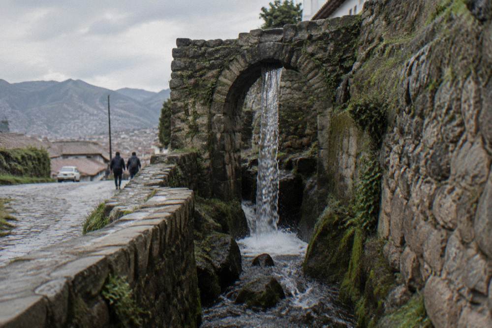
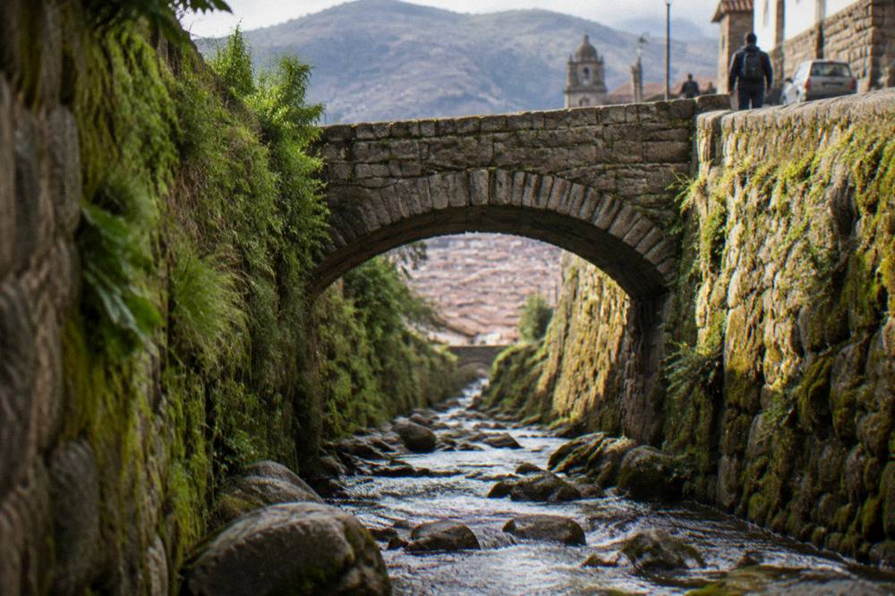
The Sapantiana Aqueduct is a stone arch aqueduct that carries a natural stream across a steep ravine on the hillside east of Cusco's historic centre, below the San Blas quarter. Water flows along the top of the arch and drops as a small waterfall into the gorge beneath it, and the site is an open public space rather than a ticketed attraction, so a visit means a walk down a quiet lane rather than a queue at a gate.
The structure is a single masonry arch, and its setting is what makes it. The ravine it spans is green and shaded, an abrupt pocket of trees and moss in a city otherwise built of stone and dust. The stream that crosses the arch, sometimes called the Tullumayu or Saphy channel in local descriptions, drops over the downstream face in a thin cascade, and the sound of falling water carries up the slope. Visitors describe a spot that feels closer to a rural gorge than to a city street, a few minutes of steep walking from the lanes of San Blas.
The name itself is Quechua in form. Local usage renders the site as Sapantiana, and the arch is widely described as a surviving piece of the old water infrastructure of the city, the network of channels and fountains that carried water from the surrounding hills through Inca Cusco and on into the colonial city that replaced it. Colonial churches in the historic centre stand on Inca stone foundations, and the water system tells a similar story of one era's engineering carrying another era's water. What a visitor sees today is the arch, the cascade, the ravine and a short stretch of path along the stream.
It is worth being clear about scale. This is not a large ruin in the manner of Sacsayhuaman, and it is not a museum with rooms and labels. It is a single arch, a waterfall and a ravine, viewable in a short visit and often combined with the walk through San Blas or the descent back toward the Plaza de Armas. That modest scale is the point: it is one of the few places in central Cusco where water, stone and greenery appear together, and it costs nothing to see.
How Do You Get To The Sapantiana Aqueduct From Cusco's Centre?
The Sapantiana Aqueduct sits on the hillside east of the Plaza de Armas, below the San Blas quarter, and the practical way to reach it is on foot from the historic centre: up through San Blas and then down the lanes toward the ravine, following the stream. There is no ticket office, no gate and no parking area, because the site is an open stretch of hillside street and path rather than a walled attraction.
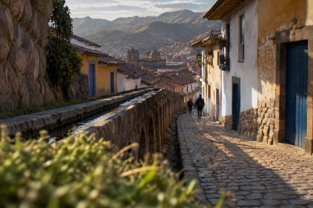
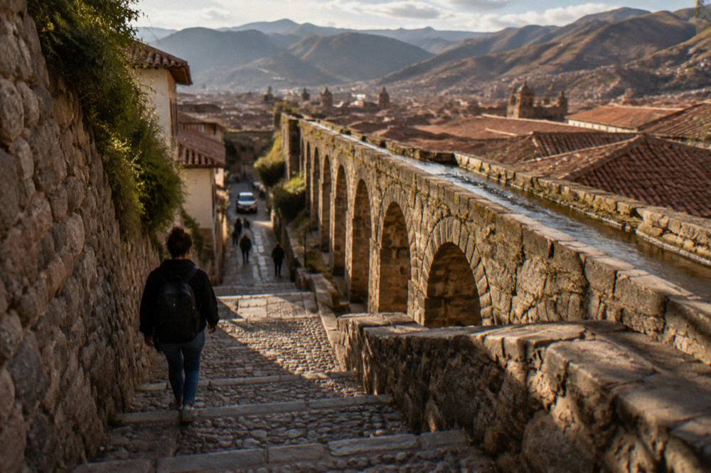
The walk starts from the Plaza de Armas and climbs into San Blas, the artisan quarter on the hill to the east of the old centre. From San Blas the route descends through narrow residential lanes toward the ravine, and the arch comes into view where the street meets the gorge. The lanes are steep, stepped in places and cobbled, typical of this flank of the city, and the last stretch runs alongside the stream. Signposting is minimal, so the reliable method is to follow the water: the channel that feeds the arch is the same water heard falling beneath it.
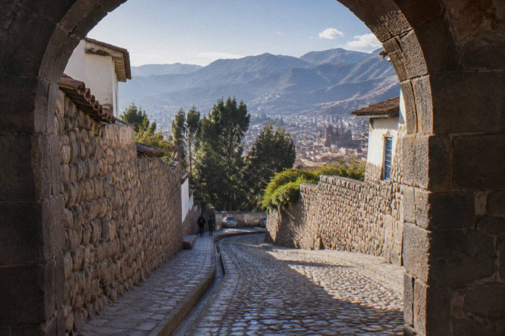
A few practical notes for the approach. The lanes around San Blas are narrow and residential, so the walk is best done in daylight. The stone can be slick after rain, and in the wet season, roughly November to March, the steps and the path beside the stream deserve slower footing. Comfortable shoes with grip matter more here than in the flat centre. Anyone combining the aqueduct with the wider hillside, including the Cristo Blanco viewpoint and the upper ruins, should treat the whole loop as a hill walk rather than a stroll.
The site also works well as a downhill stop. A common route descends from San Blas through the lanes to the arch, then continues down the stream toward the centre, passing close to the street holding the Twelve-Angled Stone, the finely fitted polygonal stone in an Inca wall on Hatunrumiyoc street. That descent turns the aqueduct into one leg of a walking circuit of the eastern hillside, ending back at the Plaza de Armas without retracing steps.
For visitors who prefer a guide on these lanes, a small-group walking tour with local guides covers the historic centre and its side streets, and the street food walk that is this page's featured tour also moves through the San Blas area with tastings along the way.
What Does A Visit To The Sapantiana Aqueduct Actually Look Like?
A typical visit is short and quiet: a few minutes at the arch itself, watching the stream cross the top and fall into the ravine, with time to walk a stretch of the path beside the water and take photographs from the lane above and the stream bed below. There is no circuit, no route system and no time limit, because the site is an open public space, and most people spend somewhere between a short pause and half an hour.
The arch first appears from above, framed by the lane and the trees of the ravine. From the upper side the view is of stone, water and greenery compressed into one frame, which is why the site has become a favourite for photographers in the early morning light. From the lower side, reached by the path along the stream, the arch is seen from beneath, with the cascade falling close enough to feel the spray on a still day. Both angles are a short scramble apart, and the ravine's steepness means the light changes quickly between them.
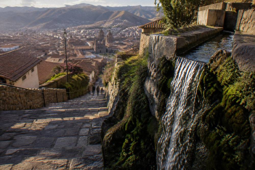
The quiet is the site's main quality. The ravine absorbs the noise of the city above it, and apart from the water the dominant sounds are birds and the occasional local resident using the lane. In the early morning the site is often empty; in the middle of the day small groups pass through in a steady trickle rather than a crowd. There is no infrastructure to speak of: no cafe, no toilets, no seating. Visitors come, look, photograph and continue, and the site asks nothing more of them.
That makes it a good counterweight to the ticketed sights. A morning that includes the Cusco Cathedral and Qorikancha is a morning of interiors and admission desks; the aqueduct is the opposite, an exterior, free and unhurried. Families with children tend to enjoy the water, and the short walk suits legs still adjusting to the altitude, provided the steep steps are taken slowly.
For anyone planning a fuller day around the eastern hillside, these are the tours that pair most naturally with a San Blas morning: a street food walk through the lanes, a South Valley day trip for the afternoon, or a cooking class with a market visit.
Is The Sapantiana Aqueduct Free To Visit In Cusco?
Yes, the Sapantiana Aqueduct is free to visit: it is an open public stretch of hillside with no ticket, no booth and no posted hours, unlike the major archaeological sites of Cusco, which sit on the COSITUC Boleto Turistico or sell their own separate admission. The aqueduct appears on no ticket, and the only costs of a visit are the walk itself and whatever a visitor chooses to spend nearby.
The contrast with the rest of the city is worth understanding when planning, because Cusco's sightseeing splits cleanly into free open spaces and ticketed sites. The Boleto Turistico del Cusco, sold by COSITUC, covers 16 sites across three partial circuits or one integral ticket, and its prices are published on the official tarifario.
| Ticket | Who it applies to | Price | Validity |
|---|---|---|---|
| Integral (BTCI) | Foreign adult | S/ 130 (about US$38) | 10 days |
| Integral (BEE) | Foreign student with ID | S/ 70 (about US$20) | 10 days |
| Partial Circuit I (Saqsayhuaman, Q'enqo, Puka Pukara, Tambomachay) | Foreign tourist | S/ 70 (about US$20) | 1 day |
| Partial Circuit II (City museums and Qorikancha site museum) | Foreign tourist | S/ 70 (about US$20) | 2 days |
| Partial Circuit III (Sacred Valley sites) | Foreign tourist | S/ 70 (about US$20) | 2 days |
COSITUC sells the boleto in person only, at its counter on Av. El Sol 103 and at most included sites; it is not sold online. The Sapantiana Aqueduct is on none of these circuits, so a visitor holding no boleto at all loses nothing by coming here. The same is true of the Plaza de Armas, the San Blas lanes and the city's street-level Inca walls: the open fabric of Cusco is free, and the tickets buy the walled sites and museums.
For orientation, here is how the central sights divide between free, boleto and separate admission, using the figures the official and PROMPERU pages publish.
| Sight | Admission basis | Price |
|---|---|---|
| Sapantiana Aqueduct | Open public space | No ticket |
| Plaza de Armas | Open public space | No ticket |
| San Blas lanes and viewpoints | Open public streets | No ticket |
| Saqsaywaman | Boleto Turistico Circuit I | S/ 70 partial (about US$20) |
| Qorikancha site museum | Boleto Turistico Circuit II | S/ 70 partial (about US$20) |
| Cusco Cathedral | Separate admission | S/ 25 (about US$7) |
| Inca Museum | Separate admission | S/ 20 (about US$6) |
| Museo de Arte Precolombino (MAP) | Separate admission | S/ 20 general, S/ 10 students |
The practical takeaway is that the aqueduct belongs to the free layer of the city, the layer a visitor can walk without planning or outlay. It pairs naturally with a morning in San Blas, a look at the Twelve-Angled Stone and a coffee in the quarter's small cafes, all of it before a single ticket is bought.
When Is The Best Time Of Year To See The Sapantiana Waterfall?
The Sapantiana waterfall runs at its fullest in the wet season, roughly November to March, when December to March alone delivers 71.9 percent of Cusco's annual 707.8 mm of rain at the WMO and SENAMHI station for the city, but the dry season, roughly May to September, offers the clear skies and firm footing that make the steep lanes easier, so the trade-off is between water volume and walkability.
Cusco sits in the southern hemisphere at high altitude, and its year divides into a dry stretch and a wet one rather than into four even seasons. The historical normal for the city, supplied by SENAMHI to the World Weather Information Service, shows the pattern month by month.
| Month | Mean max C | Mean min C | Rain mm |
|---|---|---|---|
| Jan | 18.9 | 6.6 | 145.3 |
| Feb | 18.8 | 6.5 | 133.7 |
| Mar | 19.1 | 6.2 | 107.0 |
| Apr | 19.7 | 4.9 | 43.2 |
| May | 19.8 | 2.5 | 8.7 |
| Jun | 19.5 | 0.3 | 1.5 |
| Jul | 19.1 | 0.1 | 4.0 |
| Aug | 19.8 | 1.6 | 8.6 |
| Sep | 19.8 | 3.9 | 21.8 |
| Oct | 20.9 | 5.5 | 39.4 |
| Nov | 20.7 | 6.1 | 71.9 |
| Dec | 19.4 | 6.4 | 122.7 |
For the aqueduct specifically, the rainfall figures translate into a simple rule: the more rain, the more water over the arch. In the wet months the cascade is thicker and the ravine greener, but the lanes above are slicker and the sky is more likely to be grey. In the dry months, from May to September, the waterfall thins but rarely stops, since the stream is fed from the hills above the city, and the trade is clear light and dry stone for a smaller flow. Mean daily maximums stay between 18.8 and 20.9 C all year, so daytime temperatures barely enter the decision; what changes is the night, with June and July frosts, and the rain.
Within a day, the timing that suits many visitors is early morning. The light comes over the eastern hillside into the ravine, the lanes are quiet, and the walk can be finished before the day's other plans begin. Late afternoon also works, with the same caveat about daylight and footing. The site is close enough to the centre that a change of plan costs little: if rain starts mid-visit, the retreat into San Blas is short.
What Else Is Near The Sapantiana Aqueduct On The San Blas Hillside?
The aqueduct sits inside the best free walking circuit in central Cusco: the San Blas quarter above it, the Twelve-Angled Stone and the Inca walls on the descent back to the centre, the Qorikancha site museum and the Cathedral at the bottom of the hill, and the Cristo Blanco viewpoint and Sacsaywaman on the hills to the north, so a visitor can build a full day around the eastern hillside without buying a single ticket until the ruins.
San Blas itself is the natural first stop. The quarter holds the city's artisan workshops and small galleries, its church, and a web of lanes that climb to viewpoints over the red-tiled roofs. The descent from San Blas toward the centre passes the Twelve-Angled Stone on Hatunrumiyoc street, a large, finely fitted polygonal stone in an Inca wall, one of the most photographed single stones in the city. From there the route runs down to the Plaza de Armas, with the Cathedral on its flank and the lanes of the historic centre all around.
North of the centre the ground rises again to the hills holding Cristo Blanco, the white statue viewpoint, and beyond it Sacsaywaman, the great walled site at 3,701 m, on the Boleto Turistico's Circuit I. The elevations stack up quickly on this flank of the city, which is worth keeping in mind for pacing.
| Place | Elevation | Notes |
|---|---|---|
| Cusco Plaza de Armas | 3,335 m | The reference point for the city centre |
| Sacsaywaman | 3,701 m | Boleto Turistico Circuit I, north of the centre |
| Sapantiana Aqueduct | On the slope between the Plaza and San Blas | Open public space, no ticket |
Back down in the centre, the market layer of the city is close as well. The San Pedro Market sits a short walk west of the Plaza de Armas, and a food walk through the centre and its market is one of the most direct ways to taste the region's dishes. The featured tour on this page does exactly that in a small group, and the cooking class alternative adds a market visit and a hands-on kitchen session; the South Valley day trip extends the same curiosity to the sites south of the city.
Should You Visit The Sapantiana Aqueduct While You Acclimatise In Cusco?
Yes, the aqueduct is well suited to an acclimatisation day: the walk is short, it can be abandoned at any point, it sits below the altitude of the ruins on the northern hills, and it does not commit a visitor to a schedule the way a booked tour or a ticketed site does. The CDC Yellow Book, which names Cusco as a rapid-ascent destination at about 3,350 m, prefers graded activity over exertion in the first days at altitude.
The standard advice for the first day or two in Cusco is to go gently, and the eastern hillside suits that. The climb into San Blas is steep but short, and the descent to the aqueduct is downhill, which makes the circuit easier to pace than the long slopes up to Sacsaywaman. The CDC advises travellers who ascend abruptly, as anyone flying into Cusco does, to consider acetazolamide as a prescription decision with a doctor, to avoid alcohol for the first 48 hours at high altitude, and to prefer graded ascent wherever it is feasible; it also notes that in a city like Cusco travellers can descend to lower elevations to sleep for the first nights. None of that is a reason to stay indoors: a slow walk with frequent stops is exactly the kind of light activity the first days are for.
An acclimatisation day built around the aqueduct might look like this: a slow morning walk through the historic centre, coffee in San Blas, the descent to the arch in the late morning light, then back down past the Twelve-Angled Stone to the Plaza de Armas for lunch. The afternoon can stay flat, perhaps the San Pedro Market or the museums on the boleto's Circuit II, saving the northern hills and their higher altitude for the following days. The site's guide on acclimatising in Cusco covers the fuller day-by-day approach.
For the practical costs of a first day in the city, the on-the-ground ranges reported by local sources are modest.
| Item | Reported range | Notes |
|---|---|---|
| Coca tea | S/ 2 to 5 (about US$1) | Widely available in cafes and hotels |
| Menu del dia lunch | S/ 8 to 15 (about US$2 to 4) | Set lunch menus in central restaurants |
| Airport taxi to the centre | S/ 15 to 25 (about US$4 to 7) | Reported range, agree the fare before the ride |
| Tourist SIM | S/ 5 to 15 plus a data pack of S/ 20 to 40 | Sold at airport and city kiosks |
How Does The Sapantiana Aqueduct Fit Into A Longer Cusco Itinerary?
The aqueduct is a half-hour stop, so it earns its place as a morning or late-afternoon insert inside a bigger plan: day one in the city with San Blas and the centre, day two on the northern ruins and the boleto's Circuit I, then the Sacred Valley and Machu Picchu beyond, with the arch slotted into whichever day walks the eastern hillside. It is a filler with a high return per minute, not a destination that needs its own day.
The first days belong to the city itself. The historic centre, the museums, the San Blas hillside and the aqueduct fill two comfortable days at 3,335 m, and the established itineraries for three days in Cusco and beyond treat the city as the acclimatisation base before the valley. From there the standard progression runs out along the Sacred Valley, through Ollantaytambo, Moray and the Maras salt mines, and on to Machu Picchu, the citadel at 2,430 m that gives the region its global fame. Machu Picchu has its own page on this site covering the day trip in full, including the three-circuit ticket system in force since 1 June 2024.
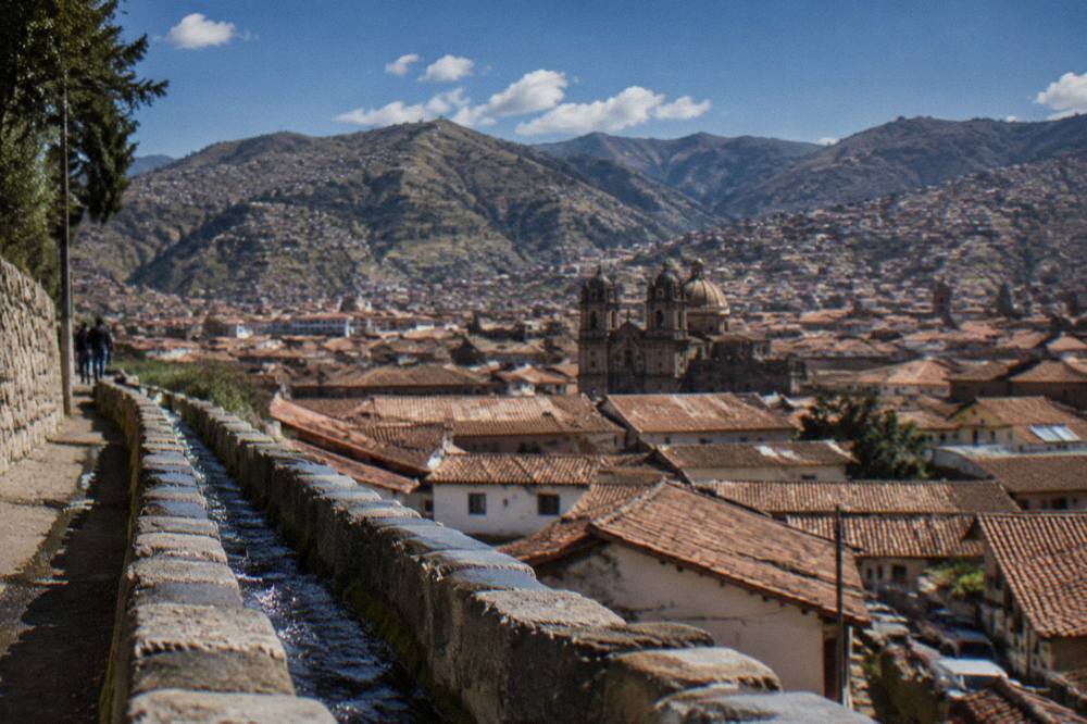
Within that arc, the aqueduct plays a small but useful role. It is the kind of sight that rewards the visitor who arrives a day early or leaves a day late, the gap-filler that turns a spare morning into a memory. It also photographs well enough to justify the walk on its own, which is more than can be said for most free stops, and it sits on a hillside that most itineraries cross anyway. The only planning it demands is footwear and daylight.
Visitors with more time on the hillside can extend east and south: the Tipon terraces and Pikillacta pre-Inca site lie on the South Valley route, and the Andahuaylillas church, often described in glowing terms for its painted interior, sits on the same road. Those sites are ticketed or boleto-listed, so they belong to the touring days rather than the free walking days, and the aqueduct stays firmly in the second category.
For the touring days themselves, these are the three experiences that pair best with a Cusco stay built around the San Blas hillside: the street food walk through the lanes, the South Valley day trip and the cooking class with cocktails and a market visit.
Common Questions About The Sapantiana Aqueduct
Is the Sapantiana Aqueduct in Cusco free?
Yes. The arch and the waterfall sit in an open public ravine below San Blas, with no ticket, no booth and no posted hours. It appears on none of the COSITUC Boleto Turistico circuits, which cover the 16 ticketed sites such as Saqsaywaman and the city museums instead.
How do you reach the Sapantiana Aqueduct from the Plaza de Armas?
On foot. The route climbs from the Plaza de Armas into the San Blas quarter on the hill to the east, then descends through narrow residential lanes to the ravine. The lanes are steep and cobbled, and the final stretch runs beside the stream that feeds the arch.
When is the waterfall at its best?
The water runs fullest in the wet season, roughly November to March, when December to March delivers 71.9 percent of Cusco's annual 707.8 mm of rain. The dry season, roughly May to September, brings clear skies, cold nights and a thinner cascade, and mean daytime maximums stay between 18.8 and 20.9 C all year.
How long does a visit take?
Most visits run from a short pause to about half an hour: time at the arch above, a look from the path along the stream below, and photographs from both angles. There is no circuit or route system, so the length of a visit is entirely the visitor's choice.
Can you combine the aqueduct with other sights?
Yes, and it works best that way. The standard free circuit runs San Blas, the aqueduct, the Twelve-Angled Stone on Hatunrumiyoc street and back to the Plaza de Armas, with the Cathedral and the Qorikancha site museum as ticketed add-ons in the centre.
Is the walk suitable right after arriving at altitude?
The CDC Yellow Book names Cusco, at about 3,350 m, as a rapid-ascent destination and prefers graded activity in the first days. The aqueduct walk is short, mostly downhill after San Blas and easy to abandon, which makes it a reasonable acclimatisation-day activity taken slowly.
The Sapantiana Aqueduct will never headline a Cusco itinerary, and that is precisely its value. It asks for half an hour, a pair of grippy shoes and nothing else, and it returns a stone arch, a waterfall and a green ravine in a city otherwise organised around tickets and queues. Walk up through San Blas in the morning, follow the water down, and be back on the Plaza de Armas before lunch, with the day's bigger plans intact and one quiet corner of the Andes already seen.