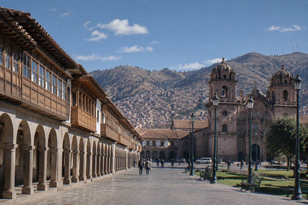
Urubamba
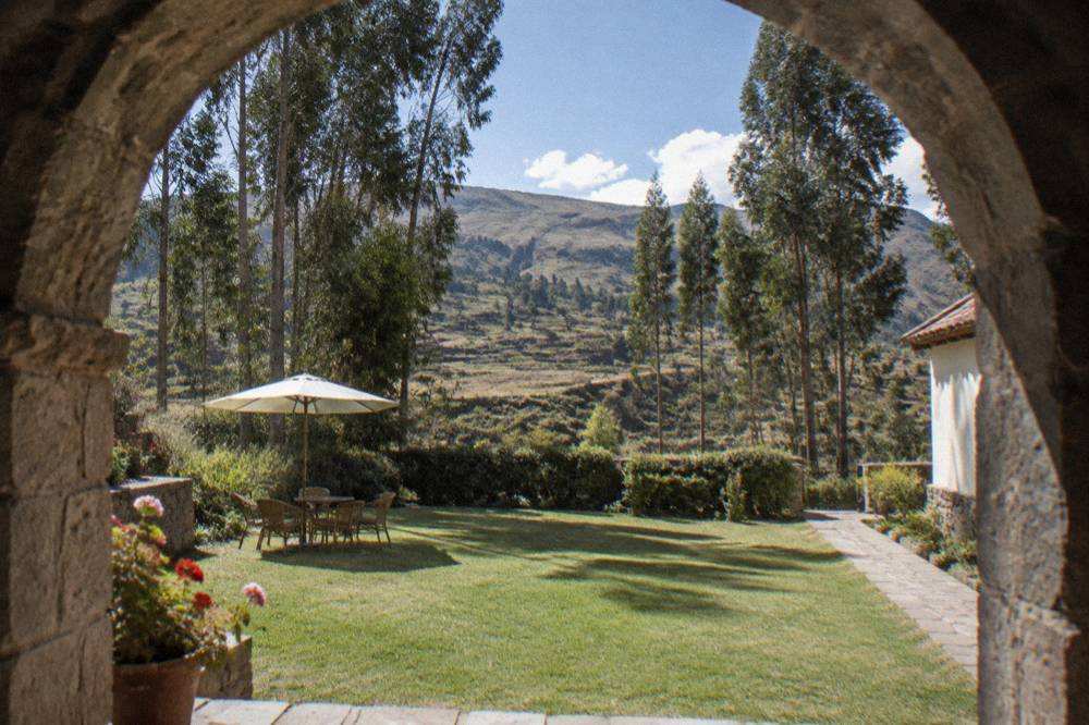
Urubamba, in Peru's Sacred Valley about an hour's road from Cusco, sits at 2,870 m, lower than the city, and works both as a base and as a stop between Moray, Maras and Ollantaytambo.
Short answer
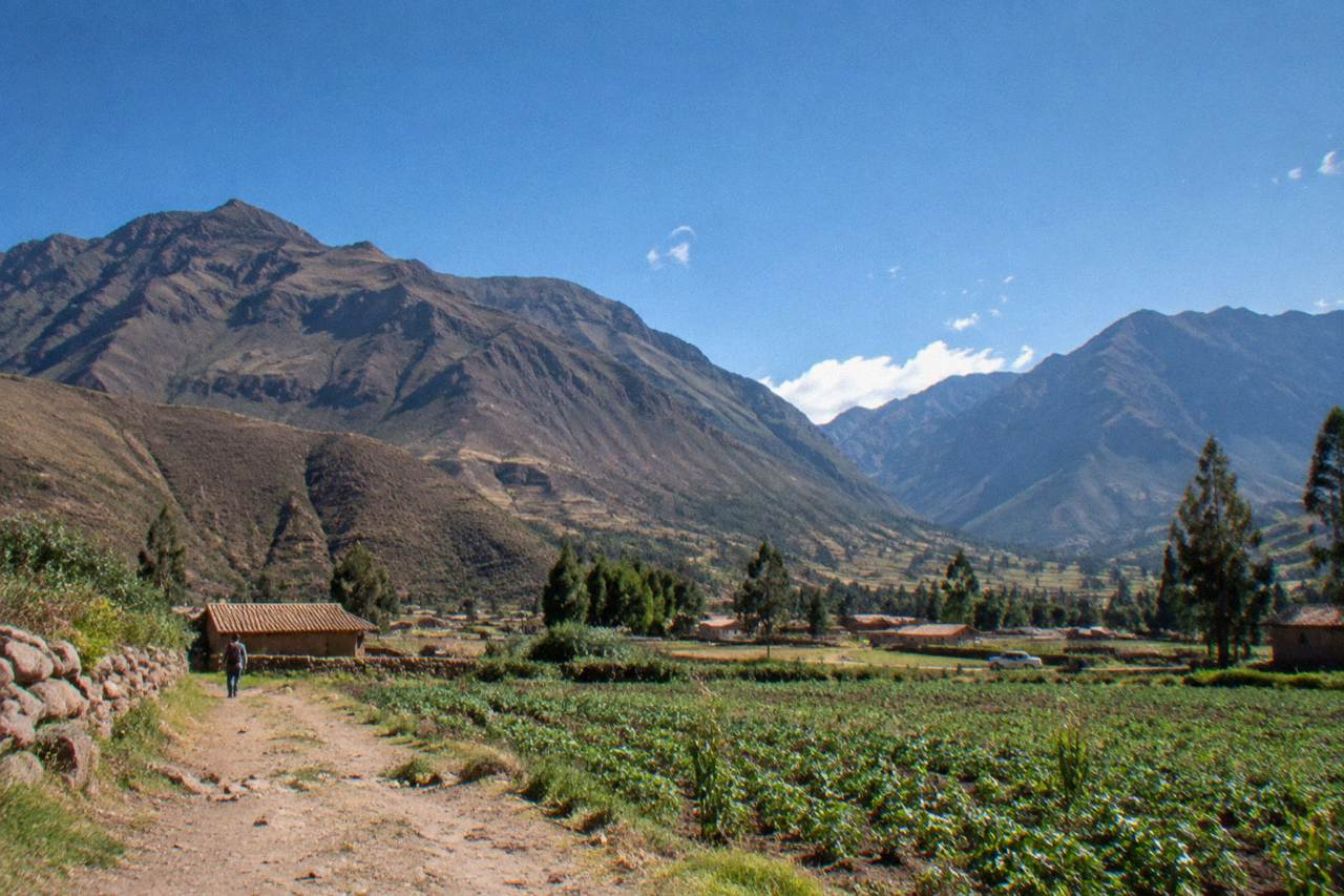
Urubamba is the largest town in the Sacred Valley of the Incas, in the Cusco region of southern Peru, at 2,870 m. Travellers use it as a lower-altitude base for Moray, the Maras salt mines, Ollantaytambo and Machu Picchu.
Urubamba is the largest town in the Sacred Valley of the Incas, in the Cusco region of southern Peru, and it sits at 2,870 m, well below Cusco's Plaza de Armas at 3,335 m. The town gives its name to the Urubamba river that runs through the valley, and it sits at the practical centre of the region travellers come to see: Moray, the Maras salt mines, Ollantaytambo, Pisac and Chinchero all ring it. This page, part of Things To Do In Cusco Peru, covers what the town is, why travellers sleep there, what sits around it, and how it connects to Machu Picchu.
Where Is Urubamba Peru?
Urubamba is a town in the Sacred Valley of the Incas, in the Cusco region of southern Peru, at 2,870 m above sea level. It sits on the Urubamba river between Pisac at 2,972 m and Ollantaytambo at 2,792 m, and the regional capital, Cusco, lies up the valley to the south east at 3,335 m.
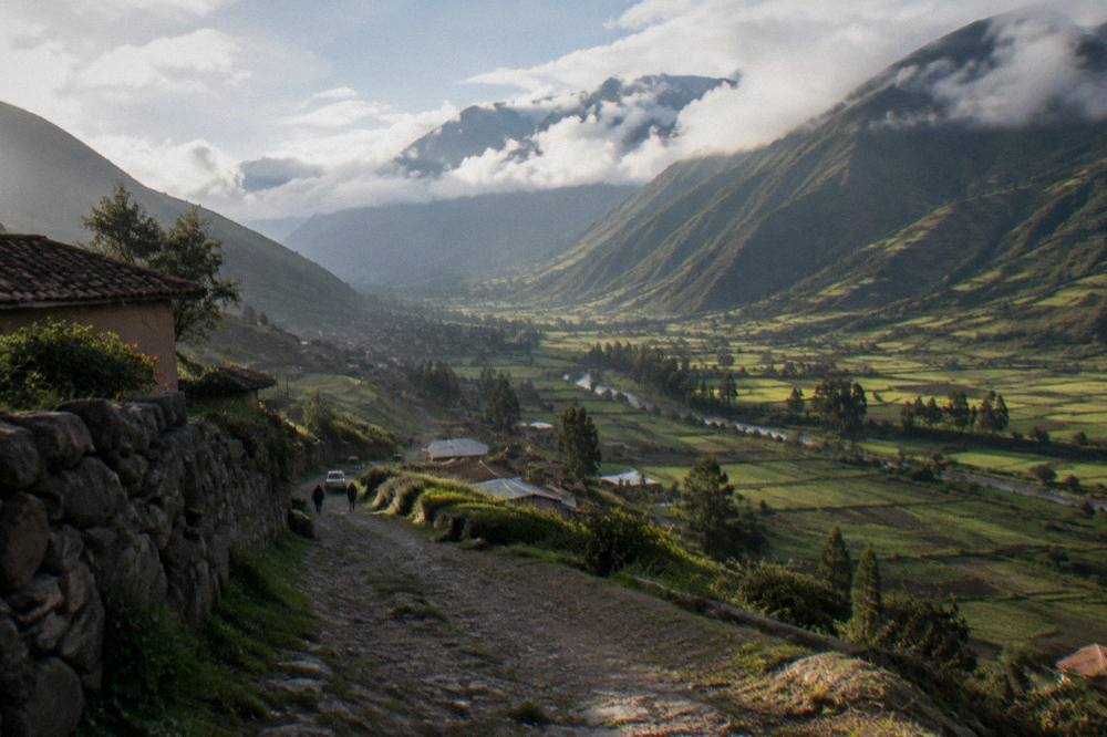
The Sacred Valley is the stretch of the Urubamba river basin that the Inca state farmed intensively, and its towns still carry that inheritance: terraces above Pisac, the agricultural rings at Moray, the salt pans of Maras and the fortress and living village of Ollantaytambo. Urubamba sits in the middle of that string, which is why so many Sacred Valley itineraries route through it, and why the town has grown into the valley's main service centre, with the widest choice of accommodation and food between Cusco and Ollantaytambo.
Elevation is the detail that quietly shapes every visit here. Cusco's Plaza de Armas stands at 3,335 m, per PROMPERU's own city page, and the CDC's Yellow Book names Cusco, at approximately 3,350 m, as a rapid-ascent destination. The valley towns all sit lower: Pisac at 2,972 m, Urubamba at 2,870 m and Ollantaytambo at 2,792 m. Moray, up on the plateau above the valley floor, is higher again at 3,385 m, and Maras sits at about 3,300 m.
| Place | Elevation | Notes |
|---|---|---|
| Cusco, Plaza de Armas | 3,335 m | Regional capital, PROMPERU figure |
| Pisac town | 2,972 m | Eastern end of the classic valley circuit |
| Urubamba | 2,870 m | Largest town in the valley |
| Maras | 3,300 m | Salt mines sit above the town |
| Moray | 3,385 m | Agricultural terraces, on Boleto Circuit III |
| Ollantaytambo | 2,792 m | Train connection to Machu Picchu |
The town itself is modest in scale. The 2017 census counted 428,450 people in Cusco city and 1,205,527 in the whole department, and Urubamba is a small fraction of that: a market town, a plaza, a church and a spread of guesthouses, restaurants and tour offices along the river. What it lacks in monuments it makes up for in position.
Why Do Travellers Sleep In Urubamba Instead Of Cusco?
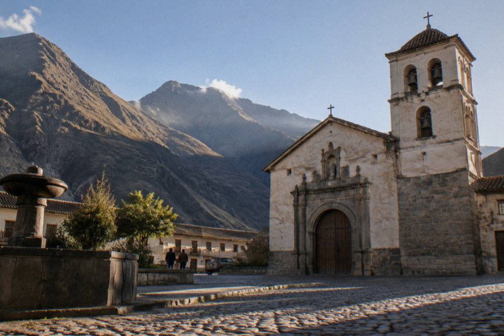
Travellers sleep in Urubamba because it sits at 2,870 m, several hundred metres lower than Cusco at 3,335 m, and the CDC's Yellow Book advises graded ascent over rapid ascent for high-altitude destinations. Sleeping lower in the valley, then heading up to Cusco, matches that advice and puts the valley's sites on the doorstep.
The CDC's guidance is worth quoting in its own terms. The Yellow Book advises travellers to avoid going from low altitude to a sleeping altitude of 2,750 m or more in a single day, to move sleeping altitude by no more than 500 m per night once above 3,000 m, and to consider acetazolamide, a prescription decision to make with a doctor, when abrupt ascent is unavoidable. It names Cusco explicitly as a rapid-ascent destination, and it notes that in some cases travellers can descend to elevations lower than the airport to sleep for the first night or two before beginning their ascent. Urubamba is exactly that lower elevation.
There is a practical side too. Ollantaytambo, twenty minutes down the valley by road at 2,792 m, is the station where the Machu Picchu trains leave: PeruRail's own FAQ gives the Ollantaytambo to Machu Picchu journey as about 1 h 45, against about 4 h 30 from San Pedro in Cusco and about 3 h 30 from Poroy. A valley base shortens the train day considerably, and it spreads the valley's sites across easy half-days rather than one long loop out of the city.
| Train leg | Journey time | Source |
|---|---|---|
| San Pedro, Cusco to Machu Picchu | about 4 h 30 | PeruRail FAQ |
| Poroy, Cusco to Machu Picchu | about 3 h 30 | PeruRail FAQ |
| Ollantaytambo to Machu Picchu | about 1 h 45 | PeruRail FAQ |
None of this makes Urubamba the right base for everyone. Cusco carries the historic centre, the Qorikancha, the Cathedral and the restaurant and nightlife weight of a city of over four hundred thousand people, and the airport is there. The honest framing is a trade: the city for atmosphere and altitude, the valley for sleep, space and the train. Travellers who want both usually split the stay, and the Sacred Valley where to stay guide compares the towns in detail.
What Sits Around Urubamba?
Four of the Sacred Valley's headline sites sit within a short drive of Urubamba: the agricultural terraces of Moray, the salt pans of Maras, the fortress town of Ollantaytambo and the market and terraces of Pisac. Chinchero, with its weavers and colonial church, completes the set, and the Boleto Turistico's Circuit III covers Pisac, Ollantaytambo, Chinchero and Moray at S/ 70 for foreign adults, about US$20.
Want to see all four sites in a single day? Book a Sacred Valley day trip here.
The Boleto Turistico is the practical key to the valley's archeological sites. COSITUC, the committee that sells it, lists 16 sites across three partial circuits plus an integral ticket at S/ 130 valid for 10 days. Circuit III, the Sacred Valley circuit, covers exactly four sites: Pisac, Ollantaytambo, Chinchero and Moray. It does not cover Machu Picchu, and it does not cover the Maras salt mines, which charge their own community fee, reported at about S/ 15 to S/ 20. COSITUC sells the boleto in person only, at the counter on Av. El Sol 103 in Cusco and at most included sites, not online.
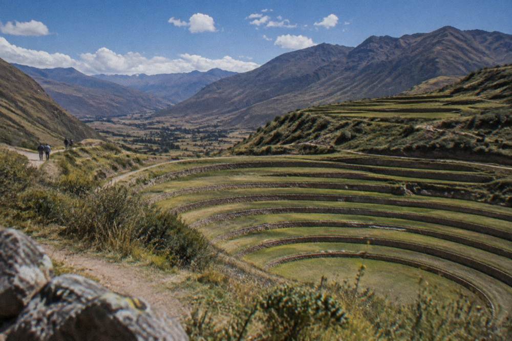
Moray is the site that photographs best from above: concentric terraced rings cut into a high plateau at 3,385 m, which the Ministry of Culture's own site inventory lists among the valley's archeological parks. The Maras salt mines, a short drive away above the town of Maras at about 3,300 m, are a hillside of thousands of small evaporation pans still worked by local families, and they charge separately from the boleto. A new 8 km asphalt road between Maras and Moray was handed over in late December 2025, which has smoothed what used to be the roughest link in the valley circuit.
| Site | Elevation | Ticket |
|---|---|---|
| Moray | 3,385 m | Boleto Circuit III |
| Pisac | 2,972 m | Boleto Circuit III |
| Ollantaytambo | 2,792 m | Boleto Circuit III |
| Chinchero | on Circuit III | Boleto Circuit III |
| Maras salt mines | 3,300 m | Community fee, reported about S/ 15 to S/ 20, cash |
| Machu Picchu | 2,430 m | Sold separately on the Ministry of Culture platform |
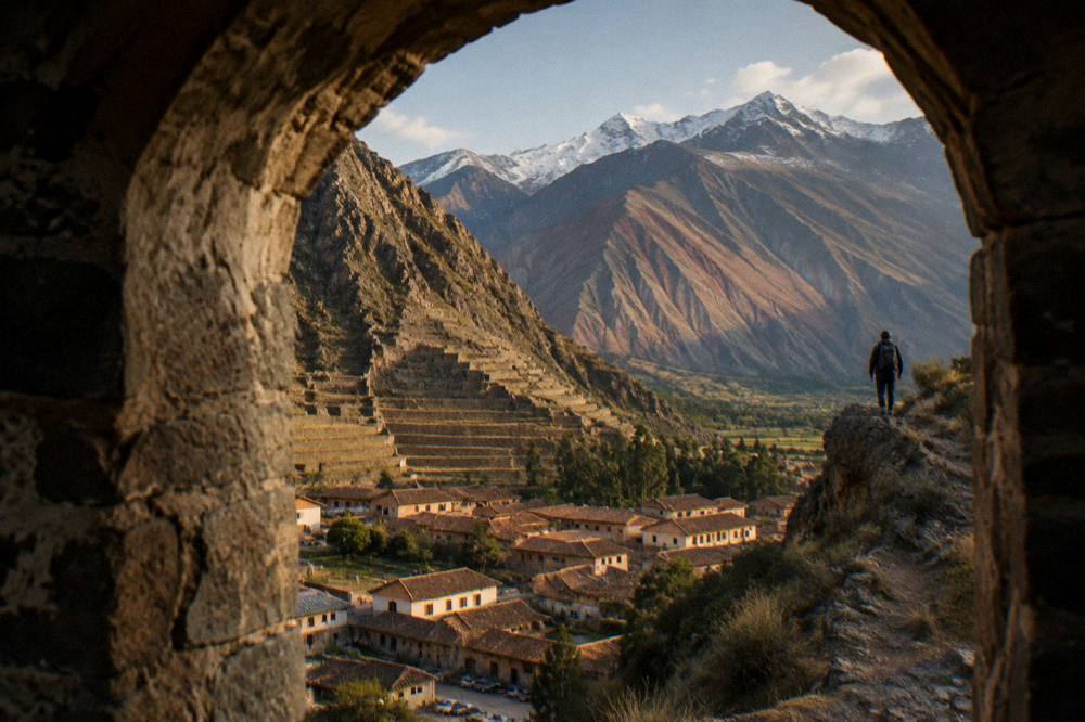
Ollantaytambo deserves its own half-day: a fortress of terraces above a village whose Inca street plan still functions, and the valley's train hub. Pisac pairs a terraced hillside citadel with a market town, and Chinchero sits high on the road back toward Cusco, known for its weaving cooperatives and its colonial church standing on Inca foundations. Awana Kancha, a textile centre with camelids and dyeing demonstrations, sits on that same road and makes an easy stop between the valley and the city.
For travellers based in Cusco rather than the valley, a guided day trip is the standard way to cover this circuit. The South Valley day trip on this site's roster runs from Cusco and can be checked on the operator's live listing, and the Sacred Valley day trip guide covers the loop in full. The valley also fits a two-day plan that pairs it with Machu Picchu, which the 2-day itinerary lays out.
How Does Urubamba Connect To Machu Picchu?
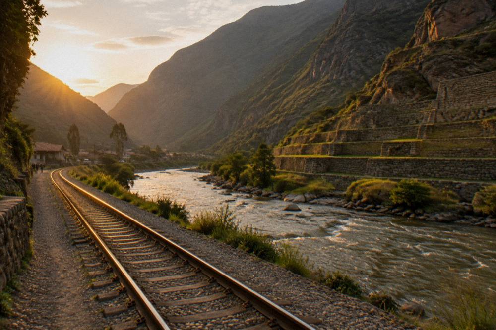
Urubamba connects to Machu Picchu through Ollantaytambo, twenty minutes down the valley by road, where PeruRail and Inca Rail trains run to Aguas Calientes in about 1 h 45. Machu Picchu itself is not in Cusco city: the citadel sits at 2,430 m, and its tickets sell separately from anything in the valley, on the Ministry of Culture's own platform.
The train leg is the part to plan around. PeruRail's FAQ gives the three Cusco-side options: San Pedro station in the city at about 4 h 30 to Machu Picchu, Poroy at about 3 h 30, and Ollantaytambo at about 1 h 45. In the wet season the Cusco-area track can be out of service and the operators run a bimodal service, bus to Ollantaytambo then train, and PeruRail's news page reported that direct train travel between Cusco and Ollantaytambo resumed from 1 September 2026. Anyone booking should check the operator's live listing for the service running on their date.
Tickets for Machu Picchu are their own subject, and this site keeps them to one honest mention. The citadel runs three circuits and ten routes since 1 June 2024, foreign adult entry runs from about S/ 163 on standard routes including the S/ 11 SERNANP fee in force since 1 May 2026, and the official platform shows the live price. A guide is recommended, not mandatory, under the September 2026 ministerial resolution. The full picture, including the circuits and the in-person ticket option at Machu Picchu Pueblo, lives on this site's Machu Picchu page.
Two products on the roster help here. Travellers who want entry and a certified guide together can check the official entry and guided tour on the operator's live listing, and those who want a bare ticket with a circuit choice can check the official ticket product the same way.
The guided-entry option suits visitors who want the citadel explained on the ground by a certified guide, with official entry handled as part of one booking. For travellers who prefer to walk the circuits on their own, or who already hold a plan and only need admission, the ticket-only product covers that case instead.
What And Where Do You Eat In Urubamba?
Urubamba eats well for a town its size, because the Sacred Valley supplies it: the valley grows the giant white maize, the potatoes and the quinoa that fill Cusco's markets, and a cluster of restaurants in and around Urubamba cooks that produce at altitude. A market lunch, a menu del dia, runs at a reported S/ 8 to 15, and the valley holds one internationally ranked restaurant, Mil, at No. 49 on Latin America's 50 Best Restaurants 2025 list.
Mil is the headline. The 2025 Latin America's 50 Best Restaurants list places Mil at No. 49: a restaurant at Moray, in the Sacred Valley rather than in Urubamba town itself, overseen by Virgilio Martinez and Pia Leon of Central. It is the one Cusco-area kitchen with that ranking; the Michelin Guide, for its part, lists no restaurants anywhere in Peru, its Peruvian-cuisine selection sitting entirely abroad. Around Urubamba the practical eating runs from set lunch menus to wood-fired Andean cooking, and the what to eat in Cusco guide covers the dishes worth knowing, from cuy to choclo con queso.
Prices on the ground follow the valley's general level. A menu del dia runs at a reported S/ 8 to 15, a cup of coca tea at a reported S/ 2 to 5, and the San Pedro market in Cusco, covered in the San Pedro Market guide, is the reference point for market food in the region. Tipping follows Peruvian custom: the How to Peru guide, a secondary source, suggests leaving up to 10 percent in restaurants only where no service charge already sits on the bill.
| Everyday item | Reported range | Note |
|---|---|---|
| Menu del dia | S/ 8 to 15 | Set lunch, valley-wide |
| Cup of coca tea | S/ 2 to 5 | Cafes and markets |
| Maras salt mines entry | S/ 15 to S/ 20 | Community fee, cash |
| Boleto Circuit III | S/ 70, about US$20 | Pisac, Ollantaytambo, Chinchero, Moray |
When Is The Best Time To Visit Urubamba?
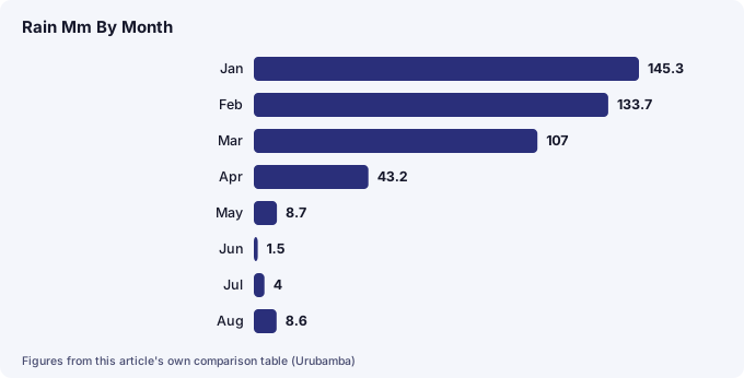
The best time to visit Urubamba is the dry season, roughly May to September, when the Cuzco station's historical normal shows May to August bringing just 22.8 mm of rain against an annual 707.8 mm. December to March carries 71.9 percent of the year's rain, so the wet season means muddy trails and cloud, though daytime temperatures barely change all year.
The climate record here is the WMO's World Weather Information Service station for Cuzco, data supplied by SENAMHI, a historical normal rather than a modern 30-year table. It shows how lopsided the year is: January alone averages 145.3 mm of rain and February 133.7 mm, while June averages 1.5 mm and July 4.0 mm. Temperatures are steadier than visitors expect. Mean daily maximums sit between 18.8 and 20.9 C in every month of the year, and the real variation is at night: mean minimums fall to 0.3 C in June and 0.1 C in July, frost season, against 6.6 C in January.
| Month | Mean max C | Mean min C | Rain mm |
|---|---|---|---|
| Jan | 18.9 | 6.6 | 145.3 |
| Feb | 18.8 | 6.5 | 133.7 |
| Mar | 19.1 | 6.2 | 107.0 |
| Apr | 19.7 | 4.9 | 43.2 |
| May | 19.8 | 2.5 | 8.7 |
| Jun | 19.5 | 0.3 | 1.5 |
| Jul | 19.1 | 0.1 | 4.0 |
| Aug | 19.8 | 1.6 | 8.6 |
| Sep | 19.8 | 3.9 | 21.8 |
| Oct | 20.9 | 5.5 | 39.4 |
| Nov | 20.7 | 6.1 | 71.9 |
| Dec | 19.4 | 6.4 | 122.7 |
Remember the hemisphere. This is the southern hemisphere at high Andean altitude: June to August is winter, dry and clear by day and cold enough for frost at night, never summer, and the wet season runs roughly November to March. The Cusco weather by month guide and the best time to visit Cusco guide unpack the trade-offs, including the crowding that comes with the dry months.
Which Day Trips And Treks Start Near Urubamba?
Urubamba sits within reach of the region's big mountain day trips: Rainbow Mountain at about 5,000 m and Palccoyo at 4,900 m, Humantay Lake at about 4,200 m, and the longer treks toward Machu Picchu, the Inca Trail and Salkantay. The valley's lower towns make it a sensible acclimatisation base first, and a launch point after.
The order matters. The CDC's graded-ascent advice, and its note that Cusco is a rapid-ascent destination, argue for valley nights before high-mountain days, and the elevations explain why: Urubamba at 2,870 m, then Rainbow Mountain at about 5,000 m, where peru.travel describes the highest point at approximately 5,200 m. Rainbow Mountain charges a community fee of S/ 25 to S/ 30 for foreigners, in cash, and Palccoyo, the lower-altitude alternative at 4,900 m, a reported S/ 20. Humantay Lake, at about 4,200 m, charges a fee that sources disagree on, between S/ 10 and S/ 20. The Rainbow Mountain page and the Palccoyo page compare the two, and the Humantay Lake page covers the lake.
The multi-day options route through or near the valley too. The classic Inca Trail starts on the Cusco side and its permits sell only through licensed agencies, 500 people a day including porters and guides, with the trail closed every February; the Inca Trail guide covers the rules. The Salkantay and Lares treks, covered in their own guides, both pass through high country within reach of a Urubamba start.
Common Questions About Urubamba
Is Urubamba worth visiting?
As a monument, no: the town itself holds a modest plaza and church. As a base, yes. It sits at 2,870 m in the middle of the Sacred Valley, within a short drive of Moray, Maras, Ollantaytambo and Pisac, and twenty minutes by road from the Machu Picchu trains at Ollantaytambo.
Is Urubamba lower than Cusco?
Yes. Urubamba sits at 2,870 m against Cusco's Plaza de Armas at 3,335 m. The CDC's Yellow Book advises graded ascent for high-altitude destinations and names Cusco as a rapid-ascent destination, which is the reason many travellers sleep their first nights in the valley.
How far is Urubamba from Machu Picchu?
By the standard route, a short road transfer to Ollantaytambo station, then about 1 h 45 by train to Aguas Calientes, the town below the citadel, per PeruRail's own FAQ. From Cusco's San Pedro station the same train leg takes about 4 h 30. The citadel itself sits at 2,430 m.
Does the Boleto Turistico cover the sites around Urubamba?
Partly. Circuit III, at S/ 70 for foreign adults, about US$20, covers Pisac, Ollantaytambo, Chinchero and Moray. It does not cover the Maras salt mines, which charge their own community fee, and it does not cover Machu Picchu, whose tickets sell separately on the Ministry of Culture's platform.
Where should I stay, Urubamba or Ollantaytambo?
Urubamba has the wider choice of hotels and restaurants; Ollantaytambo is smaller, holds the fortress and the train station, and sits at 2,792 m. The Sacred Valley where to stay guide compares them, and neither involves a hotel rate this page could quote.
What is the best month to visit Urubamba?
The dry season, roughly May to September, when the Cuzco station's historical normal shows as little as 1.5 mm of rain in June. December to March carries 71.9 percent of the year's 707.8 mm of rain. Daytime maximums stay between 18.8 and 20.9 C all year; the difference is night cold and rain.
Urubamba rewards a specific kind of traveller: the one who wants the valley's sites without a daily climb back to 3,335 m, and who values a short train leg to Machu Picchu over the city's weight of restaurants and colonial streets. For the full valley picture, start with the Sacred Valley guide and the 3-day itinerary, which pairs the valley with the city in the order the CDC's ascent advice suggests.