How Long Does It Take To Walk From Cusco To Machu Picchu?
There is no ordinary walking route from Cusco to Machu Picchu. This page explains why, what the licensed trekking routes involve, and how the train journey fits together, using verified official figures.
Cusco, the historic Inca capital in the Andes of southern Peru, sits at 3,335 m on the Plaza de Armas. Machu Picchu is not in the city at all: the citadel stands at 2,430 m, roughly 900 m lower, reached through the Sacred Valley and the town of Aguas Calientes at about 2,040 m. That elevation drop, and the river canyons in between, is the short answer to why nobody strolls from one to the other in a day.
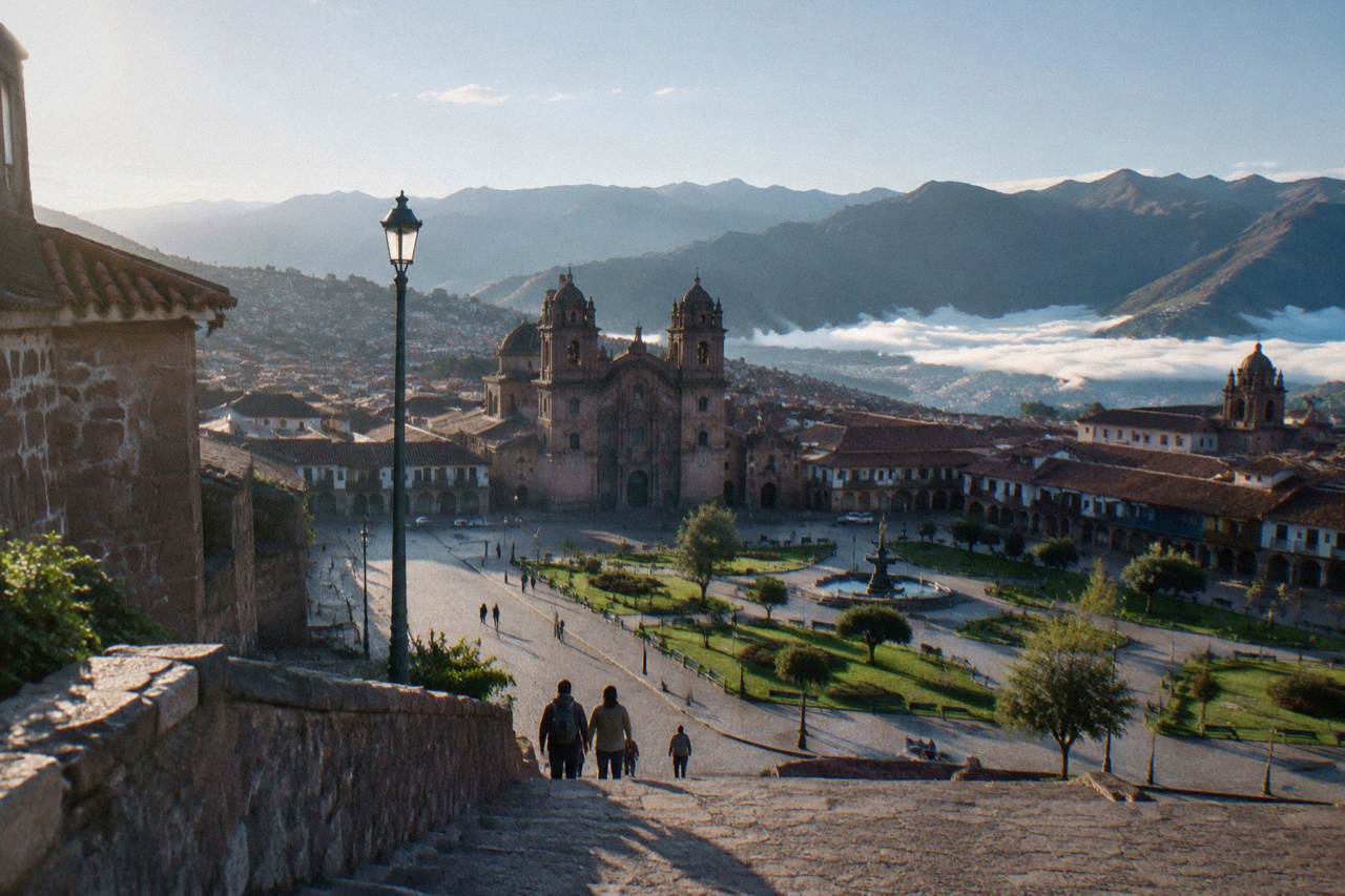
The question of walking there is a fair one, though. Cusco is a walking city, Sacsayhuaman is close enough to reach on foot, and plenty of visitors wonder whether the famous citadel is similarly walkable. This page sets out what the official sources say about the routes that do exist, the licensed treks that end at Machu Picchu, and how the train and the trails fit together. The site's own Machu Picchu day trip guide covers the visit itself in detail.
How Long Does It Take To Walk From Cusco To Machu Picchu?
No verified walking time exists for walking from Cusco to Machu Picchu as a single journey, because there is no ordinary walking route between them. The only way to arrive at the citadel on foot is a licensed multi-day trek such as the Inca Trail, which is sold only through licensed agencies under a daily quota of 500 people including porters and guides.
That answer surprises people who have read that Machu Picchu is "near" Cusco. Near is relative in the Andes. The citadel sits on a ridge above the Urubamba river canyon, and the town at its base, Aguas Calientes, has no road connection to the outside road network: travellers arrive by train or on foot. The Ministry of Culture's own ticketing arrangements, the PeruRail and Inca Rail networks, and the trekking permit system all reflect that geography. Nobody publishes a walking time for a Cusco to Machu Picchu road walk for the simple reason that the walk, as a practical route, does not exist.
What does exist, and what every source describes, is a family of licensed treks that finish at Machu Picchu. Those are the walking routes, and they are measured in days, not hours. The rest of this page covers them, plus the shorter walks around Cusco that people sometimes confuse with the real thing.
Why There Is No Ordinary Walking Route From Cusco To Machu Picchu
Aguas Calientes, the town below Machu Picchu, has no road link to Cusco: the standard arrival is by train from the Sacred Valley, and the citadel is reached from the town on foot or by bus. Walking out of Cusco toward the Sacred Valley means high passes, canyon descents and river terrain, which is why the walking routes that do exist are licensed multi-day treks rather than day hikes.
The geography tells the story. Leaving Cusco on foot, a walker climbs first: Sacsayhuaman above the city stands at 3,701 m. The route then descends through a string of valley towns, each lower than the last: Pisac at 2,972 m, Urubamba at 2,870 m, Ollantaytambo at 2,792 m. From there the terrain narrows into the Urubamba canyon, and the rail line takes over where the road gives up. Aguas Calientes, at about 2,040 m, is reachable by train or by trail, and the citadel rises above the town at 2,430 m.
The elevation profile alone explains why a day walk is off the table. Cusco is higher than Machu Picchu, a point the site covers separately in Is Cusco Higher Than Machu Picchu?, and the temperature difference between the two is its own question, answered at Is Cusco Colder Than Machu Picchu?. A walker covering the whole distance would cross high-altitude terrain first, then descend into canyon country, on trails that exist as trekking routes rather than as a connected footpath to the citadel.
For anyone planning the wider trip, the sequencing question, whether the Sacred Valley or Machu Picchu should come first, is covered at Sacred Valley Or Machu Picchu First?, and the altitude adjustment the first days require is covered at How Long To Acclimate?.
The Inca Trail: The Licensed Walking Route To Machu Picchu
The Inca Trail is the walking route to Machu Picchu, and it is strictly controlled: permits are sold only through licensed agencies, the quota is 500 people per day including porters and guides, the trail closes every February, and the permit includes Machu Picchu entry. The government portion of the permit is reported at about S/ 292 (about US$77 to 85).
This is the answer hiding inside the walking question. People do walk to Machu Picchu, in numbers, every day of the season, but they do it on the Inca Trail, a licensed multi-day trek that ends by entering the citadel through the Sun Gate rather than arriving by train. The Ministry of Culture rules are unambiguous on the mechanics: permits cannot be bought independently, only through licensed agencies, and the 500-person daily quota counts every person on the trail, porters and guides included. February is closed each year for maintenance and the wet season.
The permit itself includes Machu Picchu entry, which matters for planning: a trekker does not need to buy a separate citadel ticket for the arrival. The citadel's own ticket rules, three circuits and ten routes, nominal tickets and the current recommended-not-mandatory guide rule, are covered on the site's Machu Picchu day trip page, and the practical question of how many days the whole Cusco and Machu Picchu visit needs is covered in the Cusco And Machu Picchu itinerary.
The classic Inca Trail product on this site's roster, with the Vistadome train return, can be checked directly: Check availability. For travellers who want the citadel without the trek, a full-day group tour from Cusco is the other end of the effort scale.
Not every licensed trek to Machu Picchu is the Inca Trail. The Salkantay route crosses high mountain country to the west, the Lares route travels through valley communities to the north, and the Inca Jungle route mixes adventure activities with the final approach. All of them are multi-day undertakings with the same entry rules at the end, and all of them are sold through licensed agencies.
The Shorter Walks Around Cusco People Sometimes Confuse With It
The realistic walking from a Cusco base is short and close to the city: the walk from Cusco to Sacsayhuaman is a genuine half-day outing on foot, and the citadel itself is reached from Aguas Calientes on foot or by bus. Neither of those is a walk from Cusco to Machu Picchu, and no source publishes one.
Cusco rewards walking in a way few cities do. The Plaza de Armas, the Qorikancha museum, the twelve-angled stone on Hatunrumiyoc and the San Blas hillside all sit within a compact historic centre, and the site's Centro Historico guide covers that on-foot circuit. Above the city, the walk to Sacsayhuaman is a real, doable climb, covered at Walk From Cusco To Sacsayhuaman?, and the four ruins above the city are covered in The Four Ruins Of Cusco.
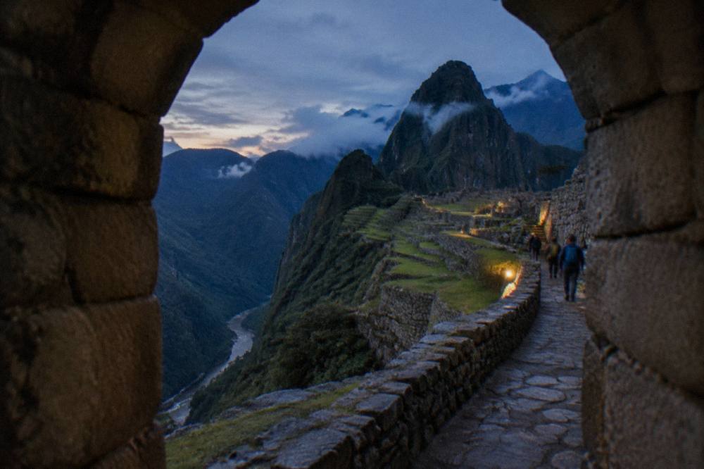
At the other end, walking is also how the citadel is reached from Aguas Calientes, on the steep path up from the town, or by the shuttle bus. That final stretch is sometimes what people mean by "walking to Machu Picchu", and it is a matter of an uphill path from the town, not a journey from Cusco. The distinction matters for planning: a visitor can walk plenty around Cusco, and walk the last stretch from Aguas Calientes, without ever walking between the two. The full index of guides sits on Things To Do In Cusco Peru.
How The Train Journey Fits Into The Trip
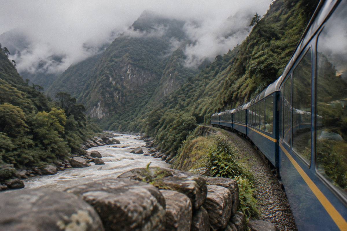
PeruRail's own FAQ gives the train times: San Pedro to Machu Picchu about 4 h 30, Poroy to Machu Picchu about 3 h 30, and Ollantaytambo to Machu Picchu about 1 h 45, with a taxi from Cusco taking about 10 minutes to San Pedro and about 20 minutes to Poroy. There are two Cusco-side stations, not one, and in wet-season disruptions a bimodal bus-plus-train option via Ollantaytambo is used.
The train is the practical counterpart to the walking question: it is how the distance is covered when it is not being trekked. Two operators run the line, PeruRail and Inca Rail, from the Cusco-side stations of Poroy and San Pedro, through Ollantaytambo, to Aguas Calientes. The journey times above come from PeruRail's own FAQ pages. In the wet season, when the Cusco-area track can be out of service, the bimodal option replaces the first leg with a bus to Ollantaytambo before the train continues.
| Leg | Reported Journey Time | Source |
|---|---|---|
| San Pedro (Cusco) to Machu Picchu | about 4 h 30 | PeruRail FAQ |
| Poroy to Machu Picchu | about 3 h 30 | PeruRail FAQ |
| Ollantaytambo to Machu Picchu | about 1 h 45 | PeruRail FAQ |
| Taxi, Cusco to San Pedro station | about 10 min | PeruRail FAQ |
| Taxi, Cusco to Poroy station | about 20 min | PeruRail FAQ |
The elevation drop along that line is the clearest picture of what a walker would face. The table below uses the site's verified elevation figures.
| Place | Elevation | Role In The Journey |
|---|---|---|
| Cusco, Plaza de Armas | 3,335 m | Start |
| Sacsayhuaman | 3,701 m | High point above the city |
| Pisac | 2,972 m | Sacred Valley town |
| Urubamba | 2,870 m | Sacred Valley town |
| Ollantaytambo | 2,792 m | Rail hub, trailhead region |
| Aguas Calientes | about 2,040 m | Town below the citadel |
| Machu Picchu citadel | 2,430 m | End, above the town |
Read together, the two tables show the whole shape of the trip: a high start, a long descent through valley towns, a canyon rail leg, and a final climb from the town to the citadel. Whether to base in Cusco or in the valley for that journey is covered at Stay In Cusco Or Sacred Valley? and Stay In Cusco Or Ollantaytambo?.
What The Inca Trail Permit Actually Covers
The Inca Trail permit covers the trail and Machu Picchu entry, is sold only through licensed agencies under a 500-person daily quota including staff, and the trail closes every February; the government portion is reported at about S/ 292 (about US$77 to 85). Trekkers still enter under the citadel's current circuit and route rules, and the permit cannot be bought independently.
| Inca Trail Rule | Current Position |
|---|---|
| Who sells permits | Licensed agencies only, never independently |
| Daily quota | 500 people, including porters and guides |
| February | Closed every year |
| Machu Picchu entry | Included in the permit |
| Government portion | about S/ 292 (US$77 to 85), reported |
| Guide requirement at the citadel | Recommended, not mandatory (RM 000334-2026-MC) |
Two points from that table deserve emphasis. First, the February closure is absolute and every year, so a walking arrival in February is simply not possible on the Inca Trail. Second, because the permit includes citadel entry, trekkers do not face the separate ticket purchase that train arrivals do, though the citadel's circuit rules apply to everyone. The site's Inca Trail guide covers the trail in full, and the alternatives at Salkantay Trek and Lares Trek.
For travellers weighing the effort, the honest framing is not "how long is the walk" but "which arrival suits the trip": the trek for the walking arrival through the Sun Gate, the train for everything else. The full-day group option from Cusco covers the citadel without any trekking, and the question of whether Cusco and Machu Picchu are the same place, which they are not, is settled at Is Cusco The Same As Machu Picchu?.
Common Questions About Walking From Cusco To Machu Picchu
How long does it take to walk from Cusco to Machu Picchu?
There is no ordinary walking route and no published walking time for the journey as a single walk. The only walking arrival is a licensed multi-day trek, most famously the Inca Trail, which runs under a 500-person daily quota including porters and guides and closes every February.
Can you walk from Cusco to Machu Picchu in one day?
No source supports a one-day walk, and the geography rules it out. Aguas Calientes, the town below the citadel, has no road link, and the walking routes that reach it are licensed multi-day treks sold only through agencies.
Is Machu Picchu higher than Cusco?
No. Cusco's Plaza de Armas is at 3,335 m and the Machu Picchu citadel is at 2,430 m, roughly 900 m lower. The town of Aguas Calientes below the citadel sits at about 2,040 m.
Do you have to take a tour to walk the Inca Trail?
Yes, in the sense that permits are sold only through licensed agencies; independent permit purchase is not possible. A guide at the citadel itself is recommended, not mandatory, under the current Ministry of Culture rules.
Does the Inca Trail permit include Machu Picchu entry?
Yes, the permit includes entry to Machu Picchu. The citadel's circuit and route rules still apply, and tickets in general are nominal, valid only for the stated date, hour, circuit and holder.
What is the closest real walk to Cusco itself?
The climb from the city to Sacsayhuaman at 3,701 m is a genuine half-day walk on foot, and the historic centre is compact and walkable. Those are the realistic walking options from a Cusco base, covered on the site's walking pages.
The short version: walking to Machu Picchu means trekking there over several days on a licensed route, and everything else about the journey runs on the rail line through the Sacred Valley.