Is Cusco Colder Than Machu Picchu?
Cusco, at 3,335 m, is colder than Machu Picchu, at 2,430 m. The WMO and SENAMHI station record for Cusco, the seasonal calendar and what to pack for both places on one trip.
Cusco, the historic city in the Andes of southern Peru, sits at 3,335 m at its Plaza de Armas. The Machu Picchu citadel, roughly 900 m lower at 2,430 m, is the milder of the two, and the town of Aguas Calientes at the foot of the site is lower still at about 2,040 m. A traveller who sleeps in the city and then drops down to the sanctuary crosses two climate bands inside a single itinerary, which is why the temperature question and the packing question turn out to be the same question.
Is Cusco Colder Than Machu Picchu?
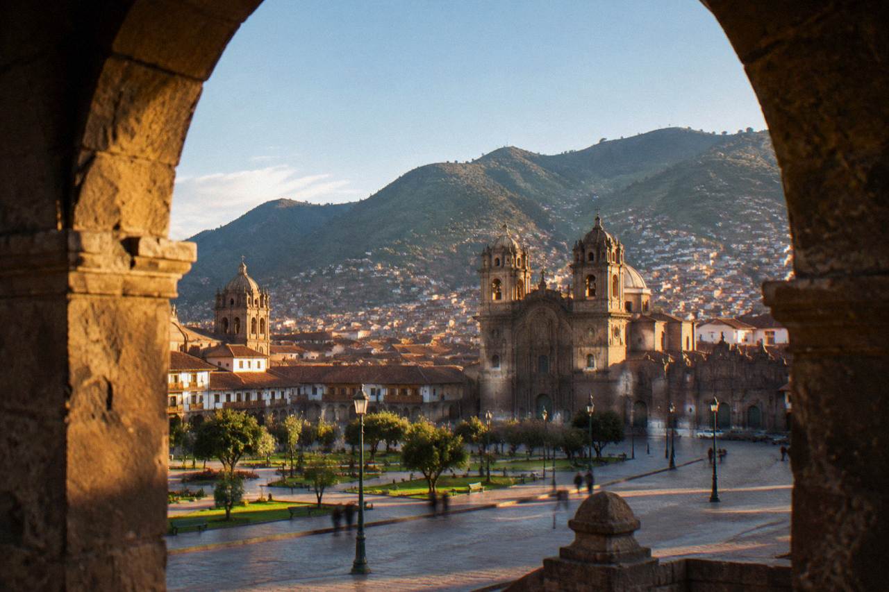
Yes, Cusco is the colder of the two, and elevation is the reason. The Plaza de Armas stands at 3,335 m, the Machu Picchu citadel at 2,430 m, roughly 900 m lower, and the town of Aguas Calientes below the site at about 2,040 m. Cusco's measured July mean minimum is 0.1 C, frost nights are common in the city's winter, and the citadel's milder position comes from its lower altitude, not from a different season.
The gap is not subtle. Air cools with altitude, and the city sleeps almost a kilometre higher than the ruins people fly in to see. The practical consequence shows up at night: a Cusco evening in the winter months can sit at or below freezing while the citadel, lower and sheltered in its mountain saddle, holds onto the day's warmth longer. Daytime tells a gentler story, since Cusco's mean daily maximum stays between 18.8 and 20.9 C in every month of the year, warm in the sun at any altitude.
It is worth being precise about which question is being asked, because three separate ones get bundled together. Cusco sits higher than Machu Picchu, and that page covers the height comparison in detail. Altitude affects the body differently at the two ends of the trip, and there is a separate answer on which place altitude hits harder. This page sticks to temperature: which place is colder, when, and what that means for a bag.
The comparison also shapes every itinerary decision covered across Things To Do In Cusco Peru, from where to sleep before the descent to how many days to give the region. Get the temperature picture right and the rest of the plan falls into place.
Why Elevation Decides The Cusco And Machu Picchu Difference
Elevation sets the baseline, and every stop between the two places sits at a different height. Sacsayhuaman, above Cusco, is at 3,701 m, the Plaza de Armas at 3,335 m, Ollantaytambo at 2,792 m and the Machu Picchu citadel at 2,430 m, with Aguas Calientes at about 2,040 m at the foot of the site. Air cools with altitude, so the higher the sleeping altitude, the colder the night.
A route from the city down to the sanctuary is a steady descent through named heights, and the table below shows how the whole corridor stacks up. The figures come from PromPeru for the Plaza de Armas, the official Machu Picchu site for the citadel, and standard geographic references for the towns in between.
| Place | Elevation | Where The Figure Comes From |
|---|---|---|
| Sacsayhuaman | 3,701 m | Wikipedia |
| Moray | 3,385 m | Wikipedia |
| Cusco, Plaza de Armas | 3,335 m | PromPeru |
| Maras | 3,300 m | Wikipedia |
| Cusco airport | 3,310 m | OpenStreetMap |
| Pisac town | 2,972 m | Wikipedia |
| Urubamba | 2,870 m | Wikipedia |
| Ollantaytambo | 2,792 m | Wikipedia |
| Machu Picchu citadel | 2,430 m | machupicchu.gob.pe |
| Aguas Calientes (Machu Picchu Pueblo) | about 2,040 m | Wikipedia |
Two things jump out of that column of numbers. First, the Sacred Valley towns, Pisac, Urubamba and Ollantaytambo, all sit well below the city, which is why many travellers sleep in the valley the night before a citadel visit and why the question of staying in Cusco or the Sacred Valley has its own answer. Second, the corridor keeps falling all the way to the river, so a single day can move through three distinct temperature bands between a Sacsayhuaman morning and an afternoon at the ruins.
The descent also explains a pattern in how trips are built. The city is the arrival point because the airport is there, at 3,310 m, and it is the coldest sleep on almost any itinerary. Everything after it, the valley, the train line, the citadel, is progressively lower and progressively milder at night. The order is not accidental, and the CDC's altitude guidance, which prefers a graded ascent and names Cusco as a rapid-ascent destination, points the same way for anyone worried about the thin air.
For travellers booking the full route, these are the site's featured options for the corridor:
What The Cusco Temperature Record Shows Month By Month
The measured record belongs to Cusco alone: the WMO World Weather Information Service station named Cuzco, supplied by Peru's SENAMHI, holds a historical normal with mean daily maximums between 18.8 and 20.9 C in every month of the year. Mean minimums range from 6.6 C in January down to 0.1 C in July, annual rain totals 707.8 mm, and no equivalent citadel normal exists to place beside it.
That last point matters for honesty. The citadel's own temperatures are not part of any published normal this site can verify, so every credible comparison comes down to elevation, which is measured exactly, and the Cusco station record, which is measured and published. The full monthly picture for the city looks like this.
| Month | Mean Max C | Mean Min C | Rain mm |
|---|---|---|---|
| Jan | 18.9 | 6.6 | 145.3 |
| Feb | 18.8 | 6.5 | 133.7 |
| Mar | 19.1 | 6.2 | 107.0 |
| Apr | 19.7 | 4.9 | 43.2 |
| May | 19.8 | 2.5 | 8.7 |
| Jun | 19.5 | 0.3 | 1.5 |
| Jul | 19.1 | 0.1 | 4.0 |
| Aug | 19.8 | 1.6 | 8.6 |
| Sep | 19.8 | 3.9 | 21.8 |
| Oct | 20.9 | 5.5 | 39.4 |
| Nov | 20.7 | 6.1 | 71.9 |
| Dec | 19.4 | 6.4 | 122.7 |
The record is a study in night-time swings rather than hot or cold months. In July the mean maximum is 19.1 C and the mean minimum 0.1 C, a daily swing of about 19 C. In January the swing is 12.3 C. A visitor experiences this as warm afternoons and genuinely cold evenings in the dry season, and as milder, wetter everything in the summer months. SENAMHI's own tourist forecast pages report even lower July minimums than this table, so the WMO figures are the conservative reading; frost nights, known locally as heladas, peak in June and July and run through a season that stretches from April to September.
The daytime half of the record is the part that surprises people. There is no month in the table where the mean maximum falls below 18.8 C, and October and November are the warmest afternoons of the year at 20.9 and 20.7 C. The sun at this altitude is strong regardless of the season, which is why sun protection belongs on the same packing list as the warm jacket, and why the question of what not to wear in Cusco has its own answer on this site.
How Cusco's Seasons Change Which Place Feels Colder
The seasons set the timing. Cusco's winter, June to August, is the dry season: clear days with mean maximums of 19.1 to 19.8 C and nights cold enough for frost, which SENAMHI says peaks in June and July. The wet season, December to March, delivers 508.7 mm of the year's 707.8 mm, 71.9 percent of the total, with milder nights and heavy rain. The same Southern Hemisphere calendar governs the whole region.
This is the Southern Hemisphere, high Andes, so the year runs opposite to Europe and North America. June to August is winter, and it is also the driest stretch on the record: May, June, July and August together bring just 22.8 mm of rain, 3.2 percent of the annual total. December to March is summer, and it is the wet stretch. SENAMHI frames the basin even more broadly, with October to April carrying 94 percent of annual precipitation in the high Cusco area.
| Period | Rain At The Cuzco Station | Share Of The Year |
|---|---|---|
| December to March, the wet season | 508.7 mm | 71.9 percent |
| May to August, the dry core | 22.8 mm | 3.2 percent |
| Full year | 707.8 mm | 100 percent |
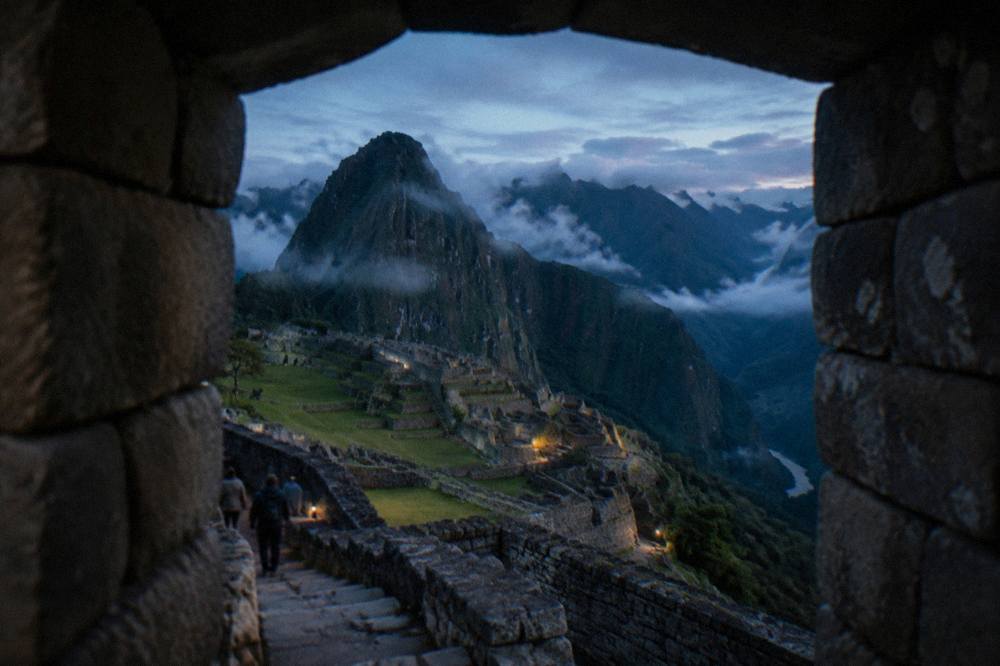
The seasonal pattern answers a quieter version of the temperature question: the cold gap between the city and the citadel is widest in the winter dry season, when Cusco's nights fall to freezing and the lower, sheltered site holds more of the day's warmth. In the wet season the gap narrows, because cloud and rain flatten the night-time differences everywhere, and the more pressing daily problem becomes staying dry rather than staying warm.
Crowds follow the calendar rather than the thermometer. The MINCETUR monthly figures for 2025 show the citadel at its busiest in the August to October stretch and quietest in February, when the Inca Trail also closes for its annual February maintenance month. Anyone weighing Rainbow Mountain or Machu Picchu first, or deciding how many days to give Cusco, is really choosing between the dry cold season's clear skies and the wet season's smaller crowds and softer light.
What To Pack For Cusco And Machu Picchu On One Trip
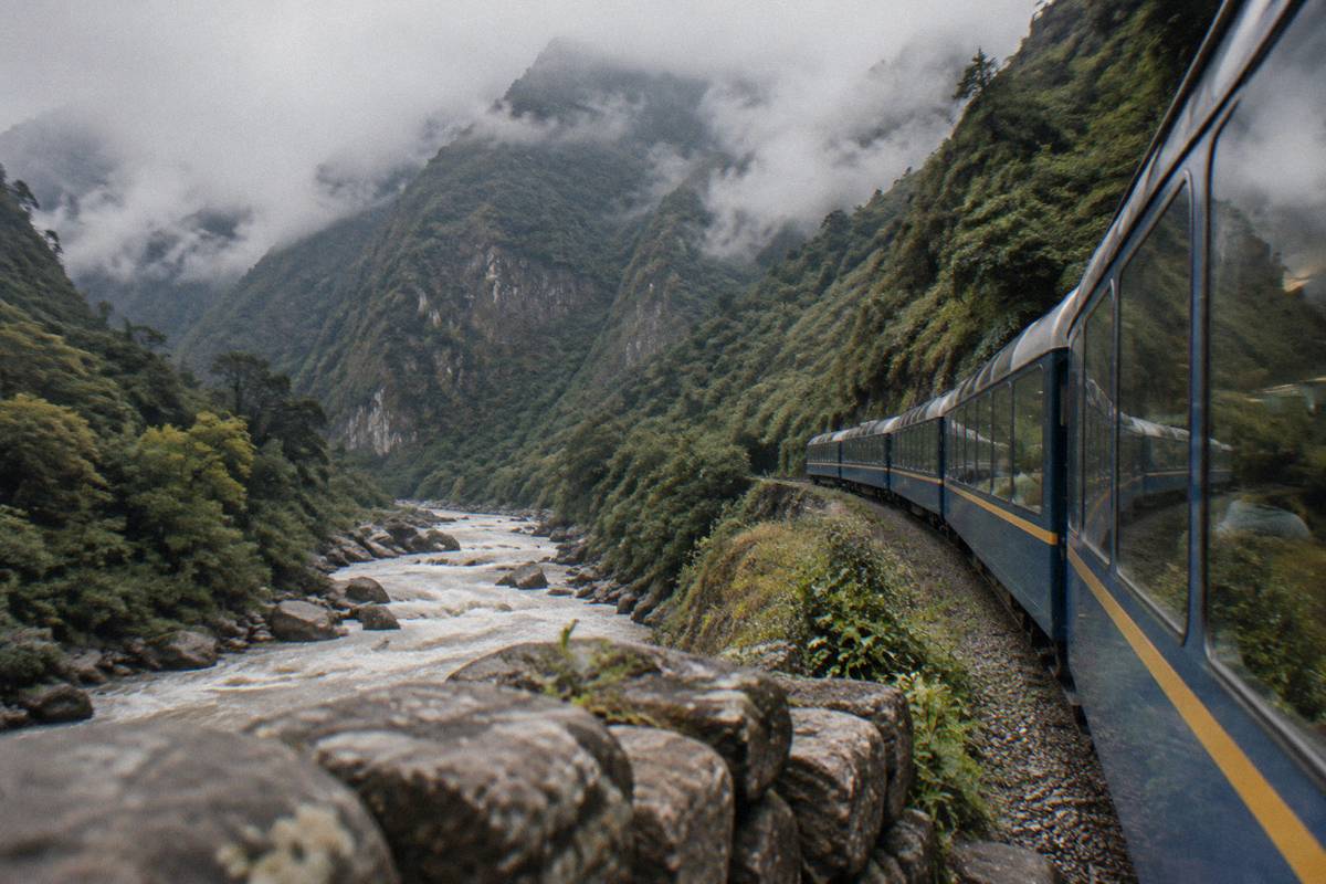
Pack for two climates in one bag. Cusco needs warm layers for nights that can sit near freezing in the winter months and sun protection for high-altitude days, while the citadel, roughly 900 m lower, asks for the same layers worn lighter plus rain gear in the wet season. The CDC's advice for high-altitude travel is to prefer a graded ascent and to talk to a doctor, including about acetazolamide, before flying in.
The concrete list is short. A warm jacket and something for sleep in a cold room for the city, sun protection for the altitude, and a rain layer if the trip falls between November and March. The CDC's Peru notice also notes that Machu Picchu sits at high altitude and is worth discussing with a doctor, and its Yellow Book adds practical points for abrupt ascents: consider acetazolamide as a prescription decision with a physician, and avoid alcohol for the first 48 hours at altitude. Nobody publishes a fixed day count for acclimatisation, and bodies differ, so the honest framing is the CDC's: graded ascent where possible, and a doctor's input where not.
The route between the two places has its own rules. The Inca Trail is sold only through licensed agencies, carries a daily ceiling of 500 people including porters and guides, closes every February, and its government permit includes citadel entry. Travellers who want the version with the Vistadome train return can check dates on the operator's live listing: Check availability. At the citadel itself, entry runs on timed circuit tickets, three circuits and ten routes since 1 June 2024, tickets are nominal and valid only for the stated date, hour, circuit and holder, and a guide is recommended rather than mandatory under the current rules. The full picture, including what each circuit covers, sits on the site's dedicated Machu Picchu day trip guide.
For a shorter visit without the trek, the full-day group tour from Cusco is the roster's straightforward option, and the card carries its own current figures:
Whatever the route, the temperature logic stays the same. Sleep high and cold in the city, descend warm to the ruins, and let the packing list cover both ends. Travellers who want the full corridor, city, valley and citadel in one plan, can start from the site's how many days to give Cusco and build outward from there.
For anyone still choosing between the main ways down the corridor, these are the featured options once more, with the mountain day trip as the high-altitude contrast to the citadel's milder air:
Common Questions About Cusco And Machu Picchu Temperatures
The short answers: Cusco is colder because it is higher, the coldest measured stretch is June and July when the Cuzco station's mean minimum sits near 0.1 C, and the citadel runs milder at 2,430 m. Frost is a Cusco winter reality, rain is a summer one, and packing for both ends of the trip means layers, a warm jacket and rain gear depending on the month.
Is Cusco colder than Machu Picchu?
Yes. The Plaza de Armas stands at 3,335 m and the citadel at 2,430 m, roughly 900 m lower, and air cools with altitude. Cusco's July mean minimum is 0.1 C with frost nights common, while the lower site sits in a milder band. The city is the colder sleep on any itinerary that includes both.
How much higher is Cusco than Machu Picchu?
Roughly 900 m, with the Plaza de Armas at 3,335 m and the citadel at 2,430 m. The airport is at 3,310 m, and Aguas Calientes, the town at the foot of the site, is lower still at about 2,040 m. The full descent is staged through the Sacred Valley towns rather than one single drop.
When is Cusco at its coldest?
June and July. The station's mean July minimum is 0.1 C and June's is 0.3 C, and SENAMHI records frost as peaking in those two months within a frost season that runs April to September. Afternoons stay mild all year, with mean maximums never below 18.8 C, so the cold is a night-time and early-morning phenomenon.
Does it rain more at Machu Picchu than in Cusco?
There is no published rainfall normal for the citadel to compare against the Cusco station, so no honest figure exists for that comparison. What the record does show is the regional calendar: December to March carries 71.9 percent of Cusco's 707.8 mm annual total, and SENAMHI attributes 94 percent of annual precipitation in the high basin to the October to April stretch.
Does the cold affect altitude sickness?
The CDC's guidance treats the two together only in the sense that both follow from altitude. Its Yellow Book names Cusco as a rapid-ascent destination, prefers graded ascent, and frames acetazolamide as a prescription decision with a doctor. It offers no probability figure for altitude sickness, and no verified number exists, so the advice is to talk to a doctor before the trip rather than to rely on a statistic.
What should one bag carry for both places?
Layers that work from a freezing Cusco evening to a mild citadel afternoon: a real jacket, warm sleepwear, sun protection for the high-altitude days, and rain gear for the November to March stretch. Sturdy footwear matters at both ends, and the site's packing answers, including what not to wear in Cusco, cover the details month by month.