Is The Rainbow Mountain In Peru Real?
Is the Rainbow Mountain in Peru real? A sourced answer on Vinicunca near Cusco: the geology, the fees, the access routes and how to tell the real thing from a filter.
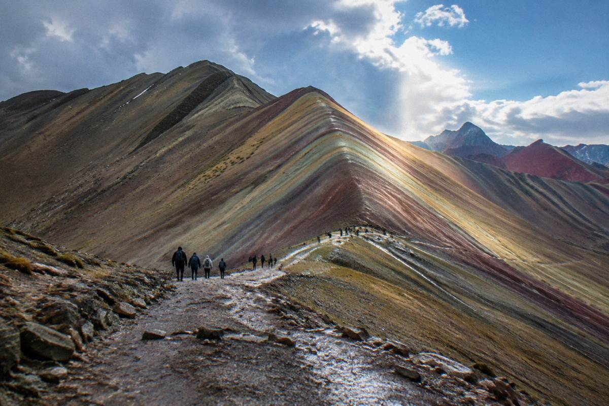
Yes, the Rainbow Mountain in Peru is real, and the mountain in question is Vinicunca, a striped ridge in the Andes of the Cusco region, reached from the city of Cusco as a long day trip. The colours in the photographs are not painted on and not a filter's invention: they are bands of mineral-rich rock exposed on a steep slope at about 5,000 m, one of the highest regularly visited points on any standard Cusco itinerary. What deserves a closer look is not whether the mountain exists but why it looks the way it does, what it costs to see it, and how much of any given photo reflects the weather on that particular day.
Is The Rainbow Mountain In Peru Real?
The Rainbow Mountain in Peru is real, and it goes by the name Vinicunca in the Cusco region of the southern Peruvian Andes. Peru's official tourism board, PromPeru, publishes its own guide to the mountain of seven colours, describing a real summit at over 5,000 m reached on foot from trailheads in the Cusco countryside. It is a natural formation, not a painted set, an art installation or a digital composite.
That confirmation matters because the mountain's fame arrived through photography, and photography is exactly where suspicion lands. The bands of colour are so regular, so saturated in some images, that the reasonable question is not whether Peru has a rainbow-striped mountain but whether the picture has been pushed a few sliders past the truth. PromPeru's own story on Vinicunca treats it as a genuine geological feature and a genuine destination, with community entry fees, trailhead villages and access routes that operators run year round. The mountain also carries a Quechua name and sits in a herding landscape of alpacas and small communities, which is difficult to fake at scale.
The honest nuance is about saturation, not existence. The rock really is banded in reds, ochres, greens and violets. On a clear dry-season morning the colours are strong enough that a phone camera needs no help. Under fresh snow, low cloud or the flat light of the wet season, the same ridge can look muted, and that gap between the calendar image and the view on the day is where most of the "is it real" doubt comes from. The day-trips guide to Rainbow Mountain covers the practical side of standing there and judging for yourself.
Where Is Vinicunca Relative To Cusco?
Vinicunca sits in high Andean country east of the city of Cusco, in the direction of the Ausangate massif, and it is visited as a full-day excursion from the city rather than as a city attraction. Two trailhead routes are in use, through Cusipata and through Pitumarca, and each charges its own community fee: S/ 25 for the Cusipata route and S/ 30 for Pitumarca, paid in cash by foreign visitors. The mountain is not visible from Cusco itself.
The two access routes matter because the fee is not a single national ticket. It is a community charge, collected in soles at the trailhead by the local communities whose land the walk crosses, and the amount depends on which side the tour approaches from. PromPeru lists S/ 30 for foreign visitors and S/ 20 for nationals, and operator guides in 2026 report the same S/ 25 to S/ 30 band for foreigners depending on route, about US$7 to US$9. Nobody sells a combined "official Vinicunca ticket" in the way Machu Picchu's Ministry of Culture platform does: access is arranged with the communities and, in practice, through a tour operator.
That is the main reason the trip is almost always booked as a guided day tour. The walk reaches about 5,000 m, far above Cusco's own 3,335 m Plaza de Armas, and the CDC's Yellow Book names Cusco as a rapid-ascent destination where altitude illness is a live concern. A guided departure handles the pre-dawn pickup, the trailhead fee logistics and the pacing. For anyone weighing the two standard ways to go, the featured trip below runs the Rainbow Mountain and Red Valley route with meals included:
The Red Valley extension is the neighbouring drainage, a landscape of deep red earth that many visitors find as photogenic as the striped summit itself, and it is offered as an option on several departures. How the full-day format compares with a self-organised trip is covered in Rainbow Mountain without a tour.
Why Are The Colours There At All?
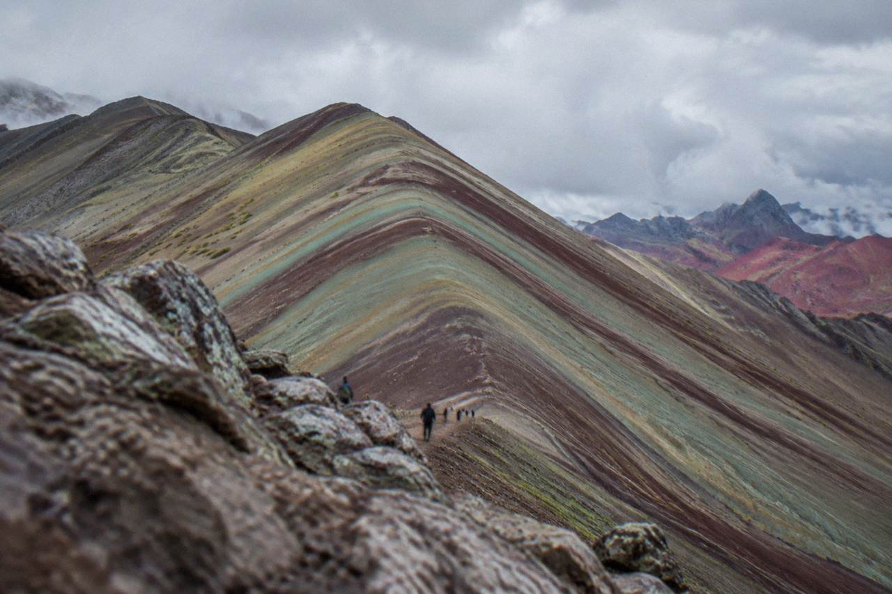
The bands on Vinicunca are layers of sedimentary rock, each layer carrying different mineral compounds that oxidise to different colours, and the whole slope has been tilted, folded and scoured by weather until the layers stand exposed as stripes across the mountainside. Red comes from iron minerals, lighter tints from other compounds in the rock, and the pattern is repeated across the Andes wherever similar layers have been cut through. It is geology doing the painting.
The key point for a sceptical reader is that the stripes run through the rock, not across its surface. A painted hillside or a filter produces colour that sits on top of the terrain; a mineral layer produces colour that continues into every gully, scar and rock face on the slope, which is exactly what the exposed sections of Vinicunca show. The same logic explains why the mountain's colours were not widely photographed until relatively recently in the tourist boom: the rock was always there, but the sightline, the foot traffic and the camera lenses arrived together.
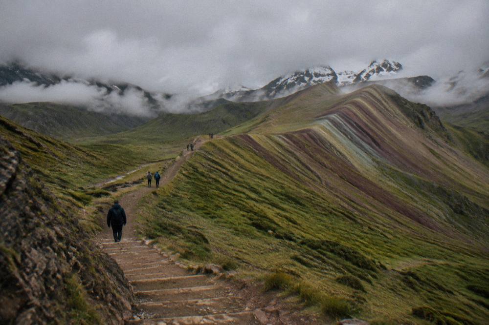
Snow is the honest caveat. At about 5,000 m the summit zone regularly carries snow cover, and in the wet season, which in this southern-hemisphere Andean climate runs roughly November to March, fresh snow or cloud can sit on the bands and mute them for hours at a time. The dry season, roughly May to September, brings the clear mornings that the famous photographs depend on. None of this changes what the mountain is; it changes what any single visit sees of it. There is no sourced weather record specific to Vinicunca, so the honest framing is seasonal and general: dry months for colour, wet months for uncertainty.
How Much Does It Cost To See The Real Thing?
The community fee at Rainbow Mountain is S/ 25 to S/ 30 in cash for foreign visitors, about US$7 to US$9, depending on whether the tour uses the Cusipata or the Pitumarca route, and that fee sits on top of whatever a guided day trip from Cusco costs. The neighbouring Palccoyo viewpoint charges about S/ 20 for foreigners, reported by operators in 2026. No part of the visit is free, and none of it is covered by the city's Boleto Turistico.
The Boleto Turistico point is worth stating plainly because it is a common piece of confusion: COSITUC's ticket covers sixteen sites across Cusco city, Saqsayhuaman's circuit and the Sacred Valley, and Vinicunca is not one of them. Natural and community sites in the region each charge separately, in cash, at the point of entry. The table below gathers the current reported figures for the sites most often bundled into a Cusco-region itinerary. The wider set of guides lives on Things To Do In Cusco Peru.
| Site | Fee for foreign visitors | Notes |
|---|---|---|
| Rainbow Mountain (Vinicunca), Cusipata route | S/ 25 (about US$7) | Cash at the trailhead |
| Rainbow Mountain (Vinicunca), Pitumarca route | S/ 30 (about US$9) | Cash at the trailhead |
| Palccoyo viewpoint | about S/ 20 (about US$6) | Operator-reported 2026; older official pages gave S/ 10 to S/ 15 |
| Humantay Lake | S/ 10 to S/ 20 | Sources disagree, so no single figure |
| Maras salt mines | S/ 15 to S/ 20 (about US$4 to US$6) | Reported 2026 |
| Q'eswachaka bridge | about S/ 20 | Operator-reported |
Elevation is the other number that belongs in any honest comparison, because it drives both the difficulty of the walk and the altitude advice that comes with it.
| Place | Elevation |
|---|---|
| Cusco, Plaza de Armas | 3,335 m |
| Vinicunca (Rainbow Mountain) | about 5,000 m |
| Palccoyo viewpoint | 4,900 m |
| Machu Picchu citadel | 2,430 m |
The CDC's Yellow Book advises graded ascent where it is feasible and names Cusco as a place where travellers arrive by air directly to altitude, which is precisely the situation Vinicunca aggravates: a walker sleeping in Cusco at 3,335 m can be standing above 4,900 m within a day or two. The CDC's practical line is to consider acetazolamide as a prescription decision with a doctor and to avoid alcohol for the first 48 hours at altitude. Nobody publishes a reliable probability figure for how likely altitude illness is on this specific walk, and the general advice on acclimatisation days is covered in how long it takes to acclimatise in Cusco.
For a trip this high and this weather-dependent, booking a departure with a flexible cancellation policy is the sensible default, and the operator's live listing shows the current terms before payment.
Is The Palccoyo Mountain The Same Real Thing?
Palccoyo is a second, genuinely striped mountain range in the same region, reached by a shorter and lower walk to a viewpoint at 4,900 m, and it is not a fake or a substitute invented for tourists: it is the same geology in an easier package. Operators and PromPeru describe it as the alternative to Vinicunca with fewer crowds and a gentler trail. Both mountains are real; they differ in effort, altitude and the number of people standing on them.
The choice between them is practical, not a choice between truth and illusion. Vinicunca is the famous summit with the steeper climb and the bigger crowds. Palccoyo spreads its colour bands across a wider ridge line, adds a stone forest of eroded rock formations nearby, and sits low enough that many walkers handle it without the struggle the main mountain demands. The full comparison, including the fee difference and the trail character, is laid out in Rainbow Mountain versus Palccoyo, and the question of which order to tackle the region's big sights in is handled in Rainbow Mountain or Machu Picchu first.
Both versions of the trip run from Cusco, and the current roster of guided departures covers the main mountain, the Palccoyo alternative and a third striped-landscape option further afield:
Pallay Punchu is the newest of the three, a striped Apu in the Andahuaylillas direction that operators have begun running as a quieter alternative, and its presence on the roster is itself evidence of the point: the striped geology is regional, not a single freak hill. For readers comparing the effort level against the region's other high walk, the Humantay comparison is covered at is Humantay harder than Rainbow Mountain.
What About The Photos: How Much Is The Filter?
The photos are real in subject and often exaggerated in colour: the striped slope exists, but many shared images have had saturation and contrast raised until the bands look like paint. The reliable test is to compare multiple photos from different sources and seasons, look for the colour continuing into gullies and rock faces rather than sitting flat on the surface, and expect the dry-season morning view to be the strongest and the wet-season view to be the most muted.
The gap between image and mountain is not unique to Vinicunca, but it is sharper here because the subject is colour itself. A cathedral looks roughly like its photos in any light; a mineral slope does not. Snow, haze and the low sun of a winter morning each move the palette, and a tour that summits in cloud can leave a walker certain the whole thing was staged. The honest planning answer is to treat the summit view as weather-dependent, to prefer a dry-season departure if the photograph is the goal, and to read the practical cautions in what to avoid in Cusco before committing to any single-day plan.
One more reassurance belongs here, because it is the question under the question. The mountain is not closed, and no closure has been reported; access is set day to day by the local communities and operators, and the honest line on any "closed" headline is covered in why is Rainbow Mountain closed. The real thing is standing there, about 5,000 m up, waiting for a clear morning.
Common Questions About Rainbow Mountain Near Cusco
Is the Rainbow Mountain in Peru real?
Yes. Vinicunca is a real mountain in the Cusco region with naturally banded, mineral-rich rock, documented by PromPeru and visited daily on guided trips from the city of Cusco.
Is Rainbow Mountain painted or artificial?
No. The colour bands are mineral layers running through the rock itself, exposed by folding and erosion, and they continue into every gully and rock face on the slope rather than sitting on the surface.
How high is Rainbow Mountain?
About 5,000 m, with PromPeru giving the highest point as roughly 5,200 m. The Palccoyo viewpoint, the lower alternative, sits at 4,900 m.
Does Rainbow Mountain cost money to visit?
Yes. Foreign visitors pay a community fee of S/ 25 to S/ 30 in cash, about US$7 to US$9, depending on the access route, and the Boleto Turistico does not cover it.
Do the colours look like the photos in real life?
On a clear dry-season morning, close to it. The bands are genuinely strong, but snow, cloud and wet-season light can mute them, and some shared images have had saturation raised well past what the eye sees.
Is Palccoyo a real Rainbow Mountain too?
Yes. Palccoyo is the same banded geology reached by a shorter walk to a viewpoint at 4,900 m, with an entry fee of about S/ 20 for foreigners reported by operators in 2026.